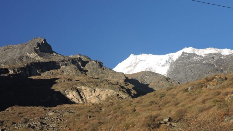
Trekking Difficulty of Langtang Valley Trek

The Langtang Valley Trek is classified as a moderate‑difficulty Himalayan trek. It involves steady altitude gain from Syabrubesi (1,550m) to Kyanjin Gompa (3,870m) with optional extensions to Kyanjin Ri (4,773m) or Tserko Ri (4,984m). This profile creates a real AMS risk, but the route remains manageable for beginners with gradual pacing and acclimatization support. A planned acclimatization itinerary reduces altitude risk.
Langtang Trek Difficulty is determined by its altitude profile, varied terrain surfaces, seasonal weather shifts, and the sustained walking pace required over several consecutive days. These factors define how trekkers experience physical load, environmental exposure, and overall progression toward higher elevations. At the same time, the route uses established trails inside Langtang National Park, which provides a structured pathway through forest zones, open valleys, and glacial surroundings.
The following sections will examine each factor in detail, including elevation patterns, trail texture, altitude‑related risks, seasonal influences, and suitability for different trekking profiles.
Table of Contents
How Difficult Is the Langtang Trek?
The Langtang Valley Trek carries a moderate difficulty rating, shaped primarily by its altitude profile, terrain variation, and exposure to shifting Himalayan weather patterns. The route begins in Syabrubesi (1,460m) and rises continuously toward Kyanjin Gompa (3,870m) inside Langtang National Park, forming the core ascent structure of the trek. Over roughly six walking days, trekkers move from lower forest environments into higher alpine terrain, where reduced vegetation and open valley landscapes define the upper section of the route. This overall pattern establishes the foundational difficulty level that later sections will analyze in more detail.
To understand why the trek is classified as moderate, four primary factors structure the difficulty:
- Altitude Progression:
The route follows a steady upward movement into the upper Langtang basin, creating a consistent elevation profile across several days. - Terrain Variation:
The trail transitions between forest pathways, rocky sections, and open valley areas, requiring stable footing and continuous walking effort. - Altitude Exposure at Higher Settlements:
Elevations near Kyanjin Gompa and its surrounding viewpoints introduce thinner air and higher physical demand. - Weather Influence on Trail Conditions:
Seasonal temperature changes and shifting weather patterns affect trail surfaces and exposure across different elevations.
Daily Elevation Gain & Trail Conditions
The elevation progression on the Langtang route follows a steady uphill pattern between its main settlements. The trail begins at Syabrubesi (1,460m) and rises through forested terrain toward Lama Hotel (2,480m), which marks the first major ascent zone. From Lama Hotel, the route continues upward to Langtang Village (3,430m), where the landscape shifts from dense forest to more open valley terrain. The final approach to Kyanjin Gompa (3,870m) brings trekkers into the upper Langtang basin, where alpine conditions and expansive glacial surroundings become prominent. This sequence forms a consistent elevation structure that shapes the physical workload across the trek.
| Night Stay | Altitude | Altitude Gain / Loss |
| Syabrubesi | 1,460 meters (4,790 feet) | – |
| Lama Hotel | 2,480 meters (8,103 feet) | 1,020 meters (3,347 feet) |
| Langtang Village | 3,430 meters (11,253 feet) | 950 meters (3,117 feet) |
| Kyanjin Gompa | 3,870 meters (12696 feet) | 440 meters (1,443 feet) |
| Kyanjin Ri/Tserko Ri | 4,773 meters (15,659 feet) /4,984m(16,532 feet) | 903 meters (2,963 feet) / 1115 meters (3,658 feet) |
| Lama Hotel | 2,480 meters (8,103 feet) | -2,503 meters (-8,211 feet) |
| Syabrubesi | 1,460 meters (4,790 feet) | -1,020 meters (-3,347 feet) |
Trail conditions vary across distinct terrain categories inside Langtang National Park. Lower sections consist of forest trails with packed earth surfaces and shaded pathways. As the trail gains height, trekkers encounter stone steps and mixed rocky segments, especially between Lama Hotel and Ghoda Tabela. Narrow valley paths appear as the landscape opens above the forest line, offering exposure on both sides of the route. Near Kyanjin Gompa, the terrain transitions toward glacial moraines, where loose rock and uneven surfaces reflect the proximity to surrounding peaks and glacial structures. These terrain shifts require adaptable pacing and steady footing throughout the ascent.
AMS Risk on the Langtang Valley Route
The altitude profile of the Langtang Valley route creates clear elevation thresholds where Acute Mountain Sickness (AMS) becomes more likely. Trekkers begin at Syabrubesi (1,460m) and reach Langtang Village (3,430m) after a rapid ascent of nearly 2,000 meters over a short time span. The route then continues to Kyanjin Gompa (3,870m), the highest standard overnight point on the trek, where oxygen levels drop further. This sequence—1,460m → 3,430m → 3,870m—defines the primary AMS‑sensitive zones on the Langtang route.
Two main settlements align closely with documented AMS risk points. Langtang Village represents the first major altitude jump, as trekkers enter elevations where AMS becomes significantly more probable. Kyanjin Gompa is the second critical point due to its higher sleeping altitude and the cumulative elevation gained in the preceding days. Both locations appear repeatedly in Langtang difficulty analyses as high‑risk transition points.
Above Kyanjin Gompa, trekkers may choose to ascend to viewpoints such as Kyanjin Ri and Tserko Ri. Kyanjin Ri reaches approximately 4,773m, and Tserko Ri rises to about 4,984m, making them the highest commonly visited points in the region. These locations introduce additional altitude exposure, as the gain from Kyanjin Gompa to either viewpoint is substantial. While these side hikes are optional, their elevations place them within zones where AMS risk increases sharply, especially without adequate acclimatization.
An acclimatization day at Kyanjin Gompa is therefore essential. Standard practice involves ascending to a higher viewpoint during the day and returning to the same sleeping altitude at night. This “climb high, sleep low” method helps the body adjust to reduced oxygen levels and stabilizes physiological responses before any optional ascent to Kyanjin Ri or Tserko Ri. This approach is consistently recommended in regional trekking guides to reduce risk before attempting higher elevations.
Is Langtang Suitable for Beginners?
The Langtang Valley Trek is generally suitable for beginners because it follows non‑technical trails and requires a manageable daily walking duration of 5–7 hours per day, as documented in multiple Langtang difficulty assessments. These walking hours align with typical Himalayan trekking standards and do not involve technical equipment or specialized climbing skills.
The route’s moderate ascent profile supports beginner participation when combined with steady pacing. Although the trek reaches higher altitudes near Kyanjin Gompa, the ascent occurs over several days, allowing the body time to adapt when the itinerary is planned with appropriate rest intervals. This structure is noted in regional difficulty guides, which classify Langtang as a moderate trek accessible to first‑time hikers who follow proper pacing.
Beginners must prepare for three essential requirements. First, consistent pacing ensures sustainable progress without overexertion, especially on long uphill segments. Second, an acclimatization day at higher settlements such as Kyanjin Gompa is important because it stabilizes the body before optional high‑point hikes; this is standard practice in Langtang itineraries. Third, basic fitness supports daily endurance and improves comfort on extended walking days, as recommended by trekking operators and regional guides. These preparations allow first‑time trekkers to manage the trek responsibly within its moderate difficulty range.
How Weather Affects Langtang Trek Difficulty
Weather conditions in the Langtang region influence the overall difficulty of the trek because temperature variation, precipitation patterns, and seasonal shifts alter the experience at different elevations inside Langtang National Park. Analyses of Langtang trek conditions show that weather plays a measurable role in determining how trekkers navigate the route, especially in higher sections near Kyanjin Gompa and the surrounding alpine terrain.
Seasonal changes form the main weather‑related difficulty factor. During colder months, temperatures drop significantly at high elevations, increasing physical strain and reducing comfort during long walking days. In contrast, warmer periods can introduce heavy moisture in lower forest zones, affecting trail conditions and increasing exposure to variable visibility. These seasonal patterns are documented in regional weather and difficulty guides, which outline how conditions shift between pre‑monsoon, monsoon, post‑monsoon, and winter periods.
Weather also influences the stability and texture of the trail. Lower sections may become humid or slippery after rainfall, while upper alpine areas near Kyanjin Gompa and below viewpoints such as Kyanjin Ri and Tserko Ri may experience snow or frost, depending on the season. Such changes affect how trekkers move across different trail surfaces, as noted in broader assessments of Langtang trekking conditions.
Langtang Trek Difficulty vs. Annapurna & Everest Regions
| Comparison Category | Langtang Valley Trek | Annapurna Circuit | Everest Base Camp (EBC) Trek |
| Overall Difficulty Rating | Moderate difficulty based on altitude, trek length, and exposure. | Higher difficulty due to longer duration and high mountain pass (Thorong La). | Higher difficulty due to sustained elevation above 5,000m. |
| Typical Trek Duration | 7–10 days on a standard itinerary. | Commonly 2–3+ weeks, depending on route variation. | About 12–14+ days, depending on acclimatization schedule. |
| Maximum Elevation Reached | Kyanjin Ri (4,773m) and Tserko Ri (4,984m) as optional side hikes. | Thorong La Pass (~5,416m) — one of Nepal’s highest trekking passes. | Everest Base Camp (~5,364m) and other high points (Kala Patthar ~5,545m). |
| Starting Elevation | Syabrubesi (1,550m) — moderate low-altitude starting point. | Varies (~800–1,000m depending on start location). | Lukla (2,860m) — higher starting altitude than Langtang. |
| Exposure to High Altitude | Lower overall altitude exposure than Annapurna Circuit and EBC. (Still includes high optional viewpoints.) | Higher exposure due to long days above 4,000m and a major 5,400m pass. | Very high exposure with several days spent above 4,500–5,000m. |
| Relative Difficulty Position | Moderate, easier than Annapurna Circuit and EBC based on altitude range and duration. | More difficult than Langtang due to altitude and trek length. | More difficult than Langtang due to altitude exposure and thinner air. |
Conclusion
The Langtang Valley Trek presents a balanced Himalayan challenge defined by its steady altitude progression, varied terrain, and exposure to shifting mountain weather. The ascent from Syabrubesi to Kyanjin Gompa forms the structural core of the route, with optional viewpoints at Kyanjin Ri and Tserko Ri extending the elevation reach into higher alpine zones. This elevation pattern introduces predictable physical demands, which increase gradually as trekkers move from forested foothills into open, glacial landscapes. The trail’s design, supported by established pathways inside Langtang National Park, ensures consistent navigation across different surface types while maintaining the trek’s moderate difficulty classification.