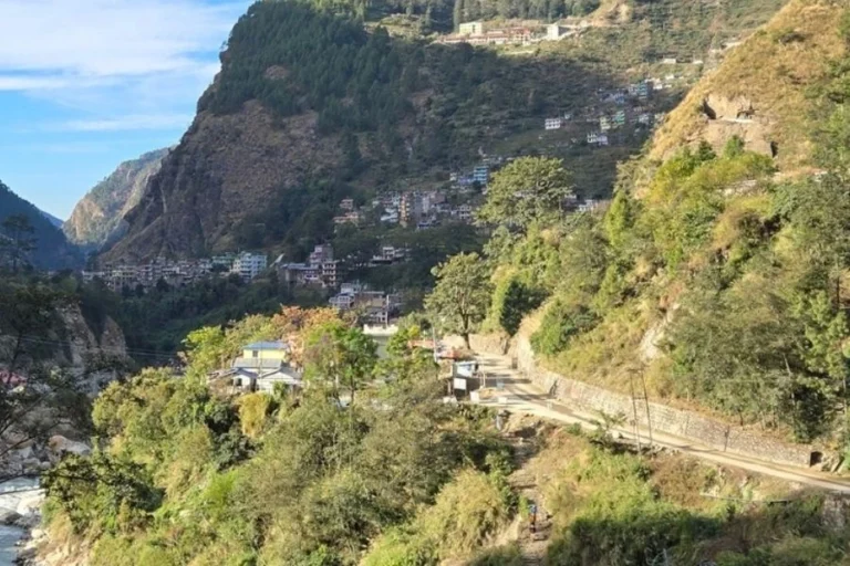
Complete Information about Langtang Village
Langtang Valley, Langtang National Park, and Rasuwa District form the geographic and cultural setting of Langtang Village. Langtang Village is one of the main villages of the Langtang region, whose topography is shaped by steep slopes, active glaciers, and the Langtang Khola river system. Local communities of Tamang, Sherpa, and Lama origin created farming and herding systems adapted to limited alpine terrain. The village’s history includes early Tibetan‑linked settlement, Buddhist cultural practices, and long-standing use of yak‑based livelihoods. Over recent decades, trekking routes connecting Syabrubesi, Lama Hotel, and Kyanjin Gompa positioned Langtang Village as a key waypoint for visitors moving through the valley. The 2015 earthquake and avalanche reshaped the landscape and led to complete relocation of the settlement, establishing a new village within the same valley under safer geological conditions.
Table of Contents
History of Langtang Village
Langtang Village holds a long cultural and environmental history shaped by high‑altitude settlement patterns, Tibetan‑influenced communities, and a landscape defined by glaciers and steep Himalayan terrain. The village developed within a remote mountain corridor that supported early agricultural systems, pastoral livelihoods, and spiritual traditions tied to local mythology. Its past includes accounts of early Tamang, Sherpa, and Lama groups who adapted to limited farmland and relied on yak herding for daily subsistence. Over time, the valley became associated with sacred origin stories, Buddhist beliefs, and unique cultural identities. With the formal recognition of Langtang National Park and the rise of trekking activity, the village evolved into a key waypoint for visitors while maintaining its traditional governance structure and mountain-based way of life.
Early Settlement
Langtang Village formed within a high-altitude corridor shaped by Tamang, Sherpa, and Lama groups. Their traditions share strong links with Tibetan cultural practices. The earliest known settlement began in the 15th century, when communities with Tibetan origins moved into the valley. They lived in an environment defined by steep slopes, glacial features, and limited farmland.
Origin Accounts and Early Livelihood
Local narratives describe a Buddhist Lama entering the valley while following a stray yak. These accounts highlight the valley’s agricultural value. Early inhabitants farmed crops suited to high elevation, such as barley and potatoes. Yak herds supported milk production, butter, and cheese making. Yaks also served as transport animals on narrow trails. This farming and herding system remained stable for centuries because the region was geographically isolated from administrative centres.
Mythological Significance of the Valley
The valley holds several spiritual and mythological associations. One important legend states that a sacred ox revealed the valley, giving it spiritual status within local culture. This view frames the valley as a place revealed by destiny, not by deliberate human discovery
Other cultural traditions describe the valley as Beyul Dagam Namgo, meaning “the heavenly gate to a half‑moon shape,” a sacred realm believed to be blessed by Guru Padmasambhava. Local communities regard the valley as a spiritual refuge where sacred spaces, meditation sites, and mountain deities shape cultural practices.
In addition to these beliefs, regional folklore includes stories about the Yeti, described as an ape‑like creature associated with remote Himalayan landscapes. These tales are common among Tamang and Tibetan-influenced communities throughout Langtang.
Administrative Recognition and Tourism Growth
The creation of Langtang National Park in 1976 increased official attention to the area, but the village continued its traditional livelihood. By the 1970s, tourism activity began to rise along trekking paths. The valley drew visitors because of its glacial lakes and its position among several high Himalayan peaks. By the early 2000s, Langtang Village received nearly 20,000 visitors each year, making it one of Nepal’s most visited trekking routes after Everest and Annapurna. Tourism income supported local farming and animal herding, and many households opened teahouses for trekkers.
Population and Local Governance
Despite high tourist numbers, the resident population was small. The 1991 census recorded 468 residents living in 100 households. Governance operated under the Village Development Committee (VDC) system. This structure coordinated local education, basic health services, sanitation, water supply, and community planning. These practices reflected Nepal’s decentralized administrative framework of that period.
The 2015 Earthquake and Destruction
On April 25, 2015, a magnitude 7.8 earthquake struck Nepal. Langtang Village experienced extreme geological impact. The earthquake caused sections of hanging glaciers on Langtang Lirung and Langtang II to break apart. The resulting avalanche generated strong pressure winds that flattened nearby forests. The avalanche buried 116 houses and caused the deaths of about 308 people, including residents, foreign trekkers, and security personnel. Reported wind speeds reached 93 miles per hour. The village was completely destroyed.
The landslide and debris flow covered the original village with massive amounts of rock, ice, and uprooted vegetation. More than 100 bodies were never recovered. The landscape shifted from farmland and grazing areas into a basin filled with debris. Trekking routes were blocked, river flow changed, and nearby settlements including Mundu, Ghodatabela, and Kyanjin Gompa remained isolated for several days. Rescue operations required helicopters because trails were impassable.
After the disaster, the community moved to a safer location within the valley. New construction methods were introduced to reduce geological risk in the future. Agricultural land, grazing plots, and accommodation services were reestablished. As trails reopened, trekkers returned to the area, supporting economic recovery. The rebuilt village now represents a model of resilience and adaptation in a region exposed to seismic hazards.


Location and Geography of Langtang Village
Langtang Village occupies a central position within the Langtang Valley, one of the most prominent Himalayan corridors inside Nepal’s Langtang National Park. Its location in Rasuwa District, approximately 40 miles northeast of Kathmandu, places it close to the Tibetan border and within a landscape defined by steep mountain walls, active glaciers, and river‑carved valley floors. With an elevation of around 3,430 meters, the village sits in a high‑alpine environment shaped by historic glacial processes and dominated by peaks such as Langtang Lirung and Langtang II.
Regional Setting
Langtang Village was located within Langtang Valley in Rasuwa District, a mountainous region in northern Nepal. The settlement lay inside Langtang National Park, approximately 40 miles (about 64 km) northeast of Kathmandu, placing it close to Nepal’s northern border with Tibet.
The village sat at an elevation of approximately 3,430 meters (11,253 feet), a height that positioned it among high Himalayan terrain heavily shaped by steep ridges, glacial basins, and river-carved valley floors.
Topographical Characteristics
Langtang Valley is a classic U-shaped glacial valley, formed by historic glacial activity that carved steep walls and created a comparatively flat valley floor. The surrounding landscape includes prominent Himalayan peaks, such as Langtang Lirung (7,227 m) and Langtang II, both rising dramatically above the settlement. These mountains contribute to the valley’s alpine climate and influence its hydrology.
The valley’s terrain consists of:
- Steep mountain slopes along the northern and southern valley flanks
- Active and debris-covered glaciers, particularly the Langtang Lirung Glacier
- Rocky outcrops, moraines, and alpine meadows shaped by glacial retreat
River Systems
The primary river flowing through the area is the Langtang Khola, a glacier-fed watercourse that runs westward across the valley floor. Meltwater from the Langtang Lirung Glacier and nearby high-altitude snowfields feeds the river. As it descends, the Langtang Khola merges with the Bhote Koshi River at Syabrubesi. Sediments carried by the glaciers give the water a distinct blue-gray color.
This river system shapes the village’s geography by:
- Defining the valley’s path
- Influencing settlement location
- Supporting agriculture through seasonal meltwater supply
Houses and Village Structure in Langtang Village
The structure of Langtang Village today reflects a complete transformation shaped by post‑disaster relocation and renewed settlement planning. After the original village site was lost under avalanche‑deposited debris, the community established a new settlement within the same valley to ensure both safety and cultural continuity. Reconstruction efforts focused on identifying stable ground, improving spacing between houses, and integrating reinforced building methods suited to the region’s geological conditions. The village’s layout now combines safer residential zones with essential communal structures such as teahouses, grazing areas, and religious spaces, allowing traditional livelihoods to continue within a more resilient framework.
Immediate Aftermath and the Decision to Relocate
The April 25, 2015 earthquake caused a massive avalanche that completely buried the original Langtang Village under millions of cubic meters of rock, ice, and uprooted forest. The debris basin created by the avalanche made it impossible to rebuild in the original location. Survivors decided to relocate the community to a more secure area within the valley. This decision was based on safety assessments indicating ongoing instability in the former village’s terrain.
Planning the New Settlement
The new Langtang settlement was designed with safety, spacing, and structural resilience as primary considerations. Community members worked with government bodies, NGOs, and engineering groups to select a safer location less exposed to avalanche paths and unstable slopes.
Reconstruction planning involved:
- Avoiding steep cliff zones known to produce hanging glacier collapses
- Increasing spacing between houses compared to the pre‑2015 layout
- Choosing terrain with reduced landslide risk
The relocation preserved cultural continuity by ensuring the village remained within Langtang Valley rather than moving residents to lowland regions.
Rebuilding Community Facilities
Community rebuilding focused not only on homes but also on essential livelihood structures:
Teahouses and Lodges
Tourism remained central to the local economy, so teahouses were among the first buildings restored. Rebuilt lodges incorporated reinforced designs to ensure safety for both residents and trekkers.
Agricultural and Livestock Infrastructure
Livelihoods centered on yak herding and subsistence farming resumed around the new settlement. Families re‑established grazing fields, grain storage areas, and small agricultural plots in safer zones that still supported traditional activities.
Monastery and Cultural Sites
While much of the original cultural heritage—including old homes and sacred structures—was lost, community members maintained spiritual continuity by establishing new religious spaces and preserving rituals practiced before 2015.
Symbol of Resilience
Today, the rebuilt Langtang Village stands as a symbol of community resilience. Rebuilding preserved traditional livelihood patterns—yak herding, farming, and trekking services—while ensuring that structures now meet modern safety requirements. The new settlement represents a balance of cultural continuity, economic revival, and disaster‑ready construction.
Local Economy and Livelihood in Langtang Village
The local economy of Langtang Village operates through a combination of tourism services, high‑altitude agriculture, and yak‑based dairy production. Its position along the main trekking route leading toward Kyanjin Gompa encourages steady movement of visitors, creating demand for lodging, food, guiding, and porter services, activities that form the primary source of monetary income for many households. At the same time, families maintain terraced fields suited to the valley’s cool alpine climate, cultivating essential crops for household use and local trade. Yak herding further supports daily needs by supplying milk, meat, and transport capacity on mountain trails. Together, these interlinked livelihood systems enable residents to balance income generation with traditional subsistence practices in a high‑mountain environment.
Tourism‑Based Income
Tourism is the central economic activity in Langtang Village. Trekkers travel through the Langtang Village to reach nearby destinations such as Kyanjin Gompa and glacial viewpoints, creating steady demand for accommodation, food, guiding services, and portering. Many households operate teahouses, lodges, and small eateries that serve international trekkers moving along the valley route. These tourism services form the primary source of monetary income for most families.
Local residents also participate in trekking support roles, including guiding, porter work, trail assistance, and transport of goods. As visitor numbers remain high along the trekking corridor, tourism continues to sustain employment throughout the village.
Agriculture in High‑Altitude Terrain
Agriculture continues to support household consumption and small‑scale trade. Families cultivate potatoes, barley, and vegetables in terraced plots adapted to steep terrain. These crops are well‑suited to the cool alpine climate of Langtang Valley. Agricultural work provides food security and helps reduce dependency on imported goods.
Villagers maintain seasonal fields near settlement areas, using simple irrigation channels fed by natural streams. Farming remains an important part of daily life, especially for producing staple ingredients used in local teahouse kitchens.
Yak Herding and Dairy Production
Yak husbandry plays a major role in the local livelihood system. Yaks supply:
- Milk
- Butter
- Meat
- Pack transport along trekking paths
Milk is used to produce butter, cheese, and yogurt, which support both household consumption and commercial sales within the trekking economy. Yak herds also hold cultural importance among local families of Tamang and Tibetan origin.
Livestock grazing occurs on high‑altitude pastures surrounding the settlement, and dairy products remain a valued commodity for both locals and visitors.
Access & Routes to Langtang Village
Access to Langtang Village follows a well‑established route beginning at Syabrubesi, the main trailhead for all treks entering Langtang Valley. This settlement in Rasuwa District functions as the logistical gateway where trekkers obtain permits, finalize supplies, and prepare for the ascent into the upper Himalaya. From Kathmandu, the journey to Syabrubesi covers roughly 122 km by road, after which the route proceeds entirely on foot through forested slopes, river corridors, and traditional Tamang villages. The trekking path is divided into gradual stages that follow the Langtang Khola and transition from dense woodland to wider alpine terrain as elevation increases. Despite remote surroundings, the approach is considered highly accessible because it requires no domestic flights and offers stable, moderate gradients suitable for most trekkers.
Primary Gateway: Syabrubesi
All routes to Langtang Village begin at Syabrubesi, the official trailhead for the Langtang Valley Trek. Syabrubesi is located in the Rasuwa District at around 1,550 meters, positioned at the confluence of the Bhote Koshi and Trishuli rivers. It functions as the final preparation point for permits, supplies, guides, and accommodation before entering the upper valley.
Travelers need two documents before proceeding past Syabrubesi:
- Langtang National Park Entry Permit
- TIMS card
These can be arranged in Kathmandu or Dhunche before reaching the trailhead.
How to Reach Langtang Village from Kathmandu
Syabrubesi lies approximately 122 km north of Kathmandu. The journey takes 7–10 hours depending on road and weather conditions. The trekking route into the valley follows a gradual ascent through forested and alpine terrain. The standard approach consists of three main segments:
Segment 1: Syabrubesi → Lama Hotel
- Trek duration: ~7 hours
- Elevation gain: ~1,550 m → 2,748 m
The trail passes through dense forest, river crossings, and small settlements.
Segment 2: Lama Hotel → Langtang Village
- Trek duration: ~7 hours
- Elevation gain: ~2,748 m → 3,430 m
The route follows the Langtang Khola, transitioning from forest to open valley landscapes. Views expand toward the Langtang range as trekkers approach the settlement area.
Route Characteristics
The route to Langtang Village is defined by:
- Rhododendron and pine forests in lower elevations
- River valleys carved by the Langtang Khola
- Tamang villages along the path
- Stable, moderate trekking gradients suitable for beginners
Trail conditions vary with season. Autumn and spring offer dry, stable paths, while monsoon brings higher risks of mud, leeches, and occasional blockages. The best time to visit Langtang Village is Autumn: October 5 to December 20 and Spring: March to May.
Why the Route Is Considered Accessible
Unlike other Himalayan regions that require domestic flights, Langtang Village is reachable entirely by road plus trekking, making it one of the most accessible high‑mountain destinations in Nepal. This road-to-trail model allows more flexibility for travel planning and makes the region suitable for shorter treks.
Conclusion
Langtang Village remains defined by its location within Langtang Valley and Langtang National Park, where high‑mountain geography, glacial systems, and river corridors shape local life. The community maintains agriculture, yak herding, and trekking‑based services as its primary livelihood structure. The rebuilt settlement reflects updated safety planning after the 2015 earthquake while preserving cultural practices rooted in Tamang and Tibetan‑influenced traditions. Access through Syabrubesi and the Langtang Khola trail continues to support steady movement of trekkers toward Kyanjin Gompa and surrounding viewpoints. Together, these geographic, economic, and cultural elements present a clear profile of a high‑altitude community adapting to both environmental conditions and long-term human use of the Himalayan landscape.