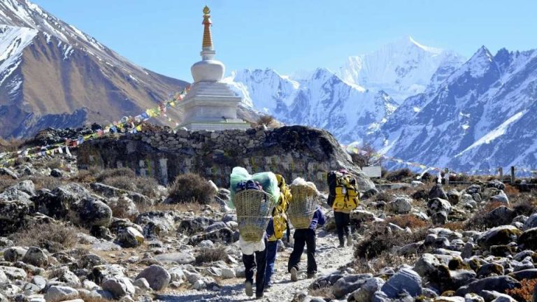
Gatlang (Popular Village in Tamang Heritage Trail)
Gatlang is a culturally significant indigenous settlement located in the Rasuwa District of northern Nepal. Situated at an elevation of 2,238 meters (7,342 ft), it serves as a primary anchor point for the Tamang Heritage Trail. Unlike high-alpine treks focused purely on mountain summits or glacial lakes, Gatlang offers a localized immersion into the traditional Tibetan-Buddhist lifestyle of the Tamang people.
Architectural and Cultural Identity
Historically, Gatlang earned the moniker the “Black Village” due to its distinctive architecture. The traditional homes were built using meticulously laid stone walls and capped with black wooden shingle roofs.
The devastating 2015 earthquake severely damaged the village, forcing structural changes. While many of the black wooden roofs have been replaced by corrugated tin and modern, earthquake-resilient materials out of necessity, the village retains its authentic character. Intricately carved wooden windows, traditional stone masonry, and deep-rooted agricultural practices—such as terraced farming and yak rearing—remain central to daily life. Gatlang is also home to local yak cheese factories and organic farms that sustain the local economy.
Key Landmarks
- Parvati Kunda: A short hike above the village leads to this sacred alpine wetland and lake, highly revered by both Hindu and Buddhist locals.
- Chhoding Monastery: The Palden Druk Gatlang Chhoding Chholing Monastery serves as the spiritual center of the village, showcasing traditional Buddhist rituals and intricate artwork.
The Tamang Heritage Trail Context
Gatlang is fundamentally tied to the Tamang Heritage Trail (THT), a trekking route specifically developed to promote community-based tourism and alleviate rural poverty. Instead of bypassing villages to reach base camps, the THT makes the villages the primary destination.
Standard Route Overview:
- Starting Point: The trek begins in Syabrubesi (1,460m), accessible via a 7-to-9-hour drive from Kathmandu.
- The Loop: Trekkers typically ascend from Syabrubesi directly to Gatlang on the second day. From Gatlang, the trail proceeds to Tatopani (known for its natural hot springs), climbs to the viewpoint at Nagthali, and descends through the villages of Thuman and Briddim before returning to Syabrubesi.
- Trek Specs: The entire loop generally takes 6 to 8 days to complete.
- Highest Elevation: The highest point of the trek is Nagthali Gyang at 3,165 meters (10,383 ft), which offers panoramic views of the Ganesh Himal, Langtang Lirung, and Tibetan mountain peaks.
Trek Difficulty and Altitude
The Tamang Heritage Trail is rated Easy to Moderate. Because the maximum altitude stays below 3,200 meters, the risk of Acute Mountain Sickness (AMS) is significantly lower compared to neighboring routes like Gosaikunda or the Langtang Valley.
However, the terrain is not flat. Trekkers must navigate continuous, undulating ascents and descents through sub-tropical forests, terraced fields, and steep river valleys. Physical fitness and stamina for 5 to 7 hours of daily walking are still required.
Optimal Trekking Seasons
- Spring (March – May): Highly recommended. The weather is stable, and the trails are lined with blooming rhododendron forests.
- Autumn (September – November): Offers the clearest skies, ensuring unobstructed views of the Ganesh and Langtang mountain ranges.
- Winter (December – February): Trekking is possible due to the lower altitude, but nights in Gatlang and Nagthali drop below freezing.
- Monsoon (June – August): Trails become muddy and prone to leeches, though the cultural aspects of the homestays remain accessible.
The Synthesis of Culture and Trekking
Gatlang exemplifies the core philosophy of the Tamang Heritage Trail: tourism as a tool for cultural preservation and economic resilience. Trekkers coming to Gatlang do not just pass through; they utilize community-run homestays, eat locally sourced traditional food, and directly contribute to the village’s ongoing post-earthquake recovery. The trek uses the physical journey through the Himalayan foothills to facilitate a direct exchange between the trekker and the indigenous Tamang community.