Langtang Valley Explained: History, Geography, Culture, Biodiversity
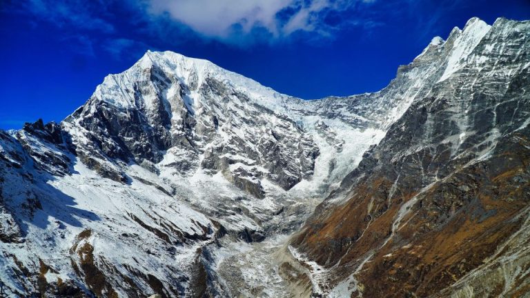
The Langtang Valley sits deep inside the central Himalayas, rising sharply from warm river gorges at 1,460 meters up to the freezing peak of Mount Langtang Lirung at 7,227 meters. Before visitors drive the 122-kilometer mountain highway from Kathmandu to the gateway town of Syabrubesi, they must clearly understand the physical and cultural landscape of this unique high-altitude region.
This comprehensive guide details 12 facts about Langtang Valley. Additionally, this article explores the region’s etymology, history, present situation, geography, climate, economy, culture, access, and trekking routes. By learning about the valley’s 15th-century Tibetan roots, the incredible community recovery after the 2015 earthquake, and the changing modern weather patterns, visitors can plan a safer, more respectful, and highly rewarding trek.
- Tibetan Roots: The local Tamang and Sherpa communities descend from Tibetan nomads who migrated to the region in the 15th century.
- Religious Makeup: Over 90% of the valley’s residents currently practice Tibetan Buddhism.
- Economic Shift: The valley transitioned from a trans-Himalayan salt trade route (which ended in the 1950s) to a tourism-based economy following the creation of Langtang National Park in 1976.
- The Disaster and Rebuilding: In April 2015, a 7.8 magnitude earthquake triggered an avalanche that completely buried Langtang Village, killing over 300 locals and trekkers. The Tamang community successfully rebuilt the village 100 meters higher in a safe zone, shifting from traditional stone architecture to earthquake-resistant concrete and steel.
- Extreme Elevation: The terrain climbs drastically from Syabrubesi (1,460 meters) to Kyanjin Gompa (3,870 meters), peaking at Mount Langtang Lirung (7,227 meters).
- Shifting Seasons: Climate change has delayed the traditional weather patterns. The optimal autumn trekking window now runs from October 5 to December 20, while the spring window runs from March to May.
- Precipitation: The summer monsoon (mid-June to early October) delivers roughly 80% of the valley’s total annual rainfall and it is not recommended to trek in monsoon.
- Yak Cheese Production: The Langtang Cheese Factory, established in Kyanjin Gompa in 1953, serves as a massive economic driver by purchasing daily yak milk from local herders to produce Swiss-style cheese.
- Cultural Practices: Locals celebrate Sonam Lhosar (Tamang New Year) and observe strict cultural rules, such as always passing to the left of Buddhist Mani walls and stupas.
- Overland Travel: Visitors must drive 122 kilometers from Kathmandu to Syabrubesi, a journey taking 6 to 9 hours via public bus or private 4WD jeep.
- Helicopter Access: Direct helicopter flights from Kathmandu to Kyanjin Gompa take just 30 to 40 minutes, carrying up to 5 passengers and providing emergency medical transport.
- The Trek: The primary route covers exactly 39 kilometers of moderate mountain trails, generally taking 8 days to complete.
Table of Contents
The Etymology of Langtang
The word “Langtang” originates from two distinct Tibetan terms rooted in Himalayan folklore. Linguistic records and local Tamang oral traditions trace the name to the phonetic combination of Lang and Tang.
Story Behind the Name “Langtang”
Hundreds of years ago, a wise Buddhist lama lived in the high mountains. He owned a magnificent yak. One day, the yak ran away into the wild. The lama decided to find him. He left his home and tracked yak’s heavy footprints through rocky passes and dangerous mountains. Finally, he followed the tracks over a high snowy ridge. Instead of more ice and rock, the lama discovered a stunning, green valley completely hidden between the snowy peaks. He found his yak resting in this beautiful new land.
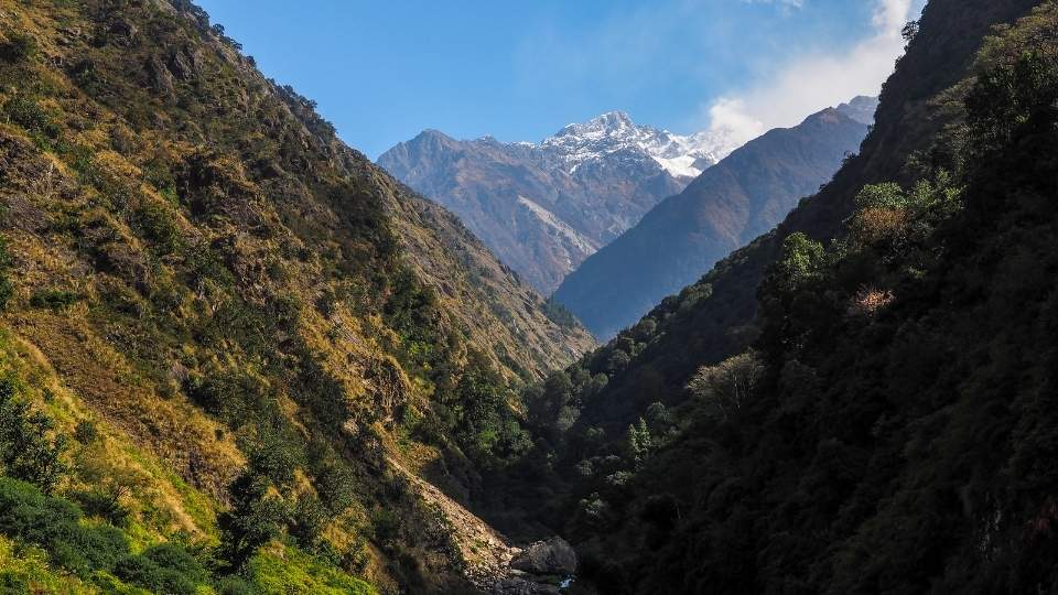
Because the lama discovered this secret paradise by chasing his runaway animal, people named the area “Langtang.” The name comes from two old Tibetan words:
- “Lang” translates to “yak.”
- “Tang” translates to “to follow.”
Therefore, Langtang literally means “the valley where the yak was followed.” Today, when trekkers walk through the Langtang region, they walk the exact same trails created by that famous lost yak centuries ago.
The History of Langtang Valley
Anthropological records and local oral histories trace the first major human settlements in the Langtang Valley to the 15th century. The region’s history is defined by three distinct phases of migration, cultural integration, and economic adaptation:
Phase 1: The Initial Tibetan Migration (15th Century to Mid-1600s)
During the 15th century, ethnic Tibetan nomads and herders initiated the primary migration into the Langtang region. These early pioneers crossed the treacherous Himalayan passes from southern Tibetan towns like Kyirong. The migrants crossed the border, sought fertile grazing pastures, escaped regional political unrest, and established the first permanent settlements in the valley.
These original settlers laid the foundation for the modern Tamang and Sherpa communities. They built traditional stone-mud houses, constructed Buddhist monasteries (gompas), and developed a resilient agropastoral economy. Today, over 90% of the valley’s residents practice Tibetan Buddhism, maintaining the exact cultural and linguistic lineage of those early 15th-century migrants.
Phase 2: The Trans-Himalayan Trade Era (1700s to 1950s)
Following the initial settlement phase, the Langtang Valley transformed into a critical commercial corridor between Nepal and Tibet. The Tamang residents leveraged their deep knowledge of the mountain passes to dominate the cross-border supply chain.
Tamang merchants led long caravans of yaks and mules across the border. The traders exported Nepalese rice, handmade agricultural tools, and regional spices to Tibet. On the return journey, the caravans imported Tibetan rock salt, thick wool, animal skins, and livestock. This lucrative barter system sustained the valley for hundreds of years. The trade era effectively ended in the 1950s when geopolitical shifts and the Chinese administration of Tibet closed the traditional borders.
Phase 3: Conservation and Tourism (1970s to Present)
The final major historical shift occurred in 1976 when the Government of Nepal established Langtang National Park. This conservation mandate permanently altered the valley’s economic structure. The Tamang residents transitioned from cross-border merchants to trekking guides, teahouse operators, and cultural ambassadors.
Currently, thousands of international trekkers walk these exact ancient migration trails annually. Visitors experience a living history, observing the same traditional farming techniques, dialect, and architecture introduced by the original Tibetan migrants over 500 years ago.

Langtang Valley Today
In April 2015, a terrible 7.8 magnitude earthquake shook Nepal. The shaking caused a massive avalanche of ice and rocks to fall from Mount Langtang Lirung. This deadly landslide completely buried the original Langtang Village and tragically took the lives of over 300 locals and trekkers. Today, the bowl where the old village sat remains covered in rubble as a quiet memorial.
However, the local Tamang people refused to abandon their mountain home. They built a completely new Langtang Village about 100 meters higher up the valley. This new location sits on very safe, solid ground, far away from the dangerous avalanche paths.

The new village is stronger and more welcoming than ever before. Local families now operate clean, modern teahouses along the route. Instead of basic huts, these new teahouses feature strong stone walls, thick blankets, and large dining room windows. Trekkers easily find solar-powered electricity to charge phones, hot water showers, and reliable Wi-Fi connections.
Safe Trails and Trekker Numbers
Workers and volunteers have fully restored the entire trekking route from Syabrubesi to Kyanjin Gompa. As you walk, you cross secure metal suspension bridges over rushing mountain rivers. You step up freshly carved stone stairs that guide you safely through thick pine and bamboo forests.
Because the trails and teahouses are safe again, visitors have returned to help the local economy. During the 2022-2023 trekking season, roughly 25,000 trekkers visited the valley. This strong recovery makes Langtang the third most popular trekking region in Nepal. Even with 25,000 yearly visitors, the Langtang trails never feel crowded. The wide, open valley gives every hiker plenty of personal space.
Geography of Langtang Valley
Location and Borders
The Langtang Valley sits securely inside the Rasuwa District of central Nepal. Massive northern mountain ridges (Langtang Lirung and adjacent Himalaya) create a physical, natural wall between Nepal and Tibet.

Topography of Langtang Valley
The physical shape of the Langtang Valley changes dramatically as you climb. The journey begins low in the town of Syabrubesi at an elevation of 1,460 meters. At this starting point, the topography features deep, narrow rock gorges and warm, thick forests.
As you walk higher up the trail, the narrow gorge opens into wide, flat mountain pastures. You eventually reach the village of Kyanjin Gompa at 3,870 meters. At this high elevation, tall trees disappear, and short alpine bushes cover the ground. Directly above Kyanjin Gompa, the land rises sharply into steep, frozen rock walls. These walls climb straight up to the top of Mount Langtang Lirung, which touches the sky at exactly 7,227 meters. This massive jump from 1,460 meters to 7,227 meters creates one of the steepest elevation profiles in the world.
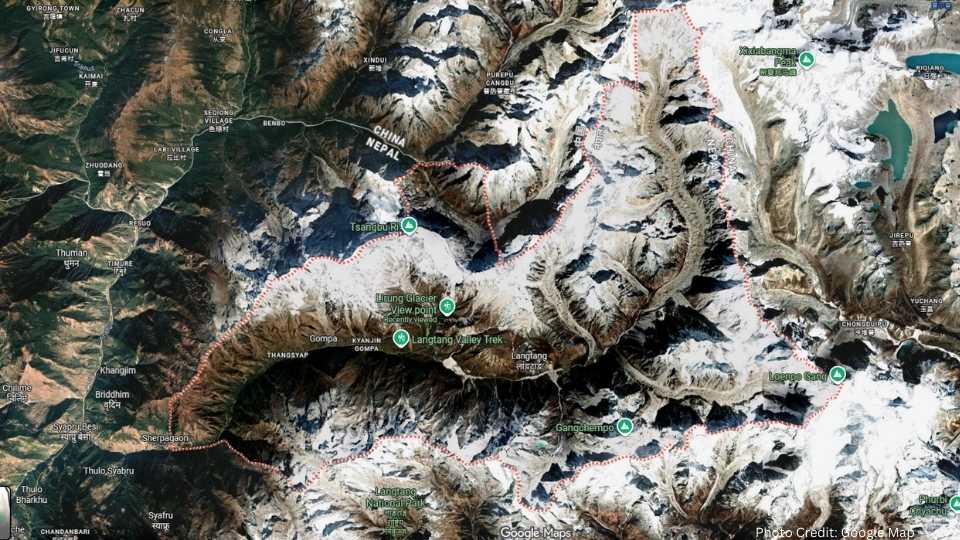
River Systems: Following the Langtang Khola
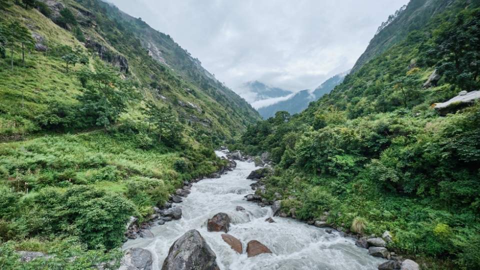
Fast-moving water carves and shapes the entire Langtang landscape. The Langtang Khola, a powerful mountain river, cuts directly through the center of the deep valley gorge. This main river provides essential fresh water to the local pine forests, wildlife, and the terraced farms built by the local villages.
The water system starts high above the valley floor. Melting ice from the mountain peaks forms hundreds of small, freezing streams. These tiny rivers flow down the steep rock walls at almost every point along the trail. All of these small streams eventually crash down into the gorge to feed the rushing Langtang Khola.
Glaciers and Icefalls: Valley of Glaciers
Massive ice formations hang directly above the main valley trails. Trekkers can easily view the famous Lirung Glacier resting just above Kyanjin Gompa. This giant river of solid ice moves slowly down the mountain, crushing rock and carving the shape of the land.
Because the surrounding mountains hold dozens of these large glaciers, trekkers proudly call Langtang the “valley of glaciers.” These frozen formations store millions of gallons of fresh water, making the Langtang Valley a critical geographic center for the local environment.
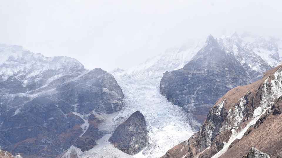
Mountains in the Langtang Valley
The Langtang Valley is enclosed by a massive wall of high-altitude peaks that form the natural border between Nepal and Tibet. These mountains dictate the local climate and feed the valley’s river systems through seasonal glacial melt.
- Langtang Lirung (7,227 meters) – The highest peak in the Langtang Range.
- Langshisha Ri (6,427 meters)
- Dorje Lakpa (6,966 meters)
- Gangchenpo (6,387 meters)
- Yala Peak (5,520 meters)
- Naya Kanga / Ganja La Chuli (5,844 meters)
- Kingshung (6,011 meters)
- Yubra (6,264 meters)

Tserko Ri and Kyanjin Ri are two popular hiking peaks in Langtang region.
Villages in Langtang Valley
The Langtang Valley holds a continuous line of mountain villages that stretch from warm river gorges up to freezing alpine glaciers. Starting at Syabrubesi (1,460 meters) and ending at Kyanjin Gompa (3,870 meters), these historic settlements form the cultural heart of the region. Learning about these specific locations helps visitors safely manage the changing altitudes, pack the correct clothing for different weather, and connect directly with the local Tamang culture at every stop along the mountain trail.
- Syabrubesi
- Thulo Syabru
- Bamboo
- Sherpagaon
- Rimche
- Lama Hotel
- Riverside
- Ghodatabela (3,030 meters)
- Thangshyap (3,140 meters)
- Chamki (3,230 meters)
- Langtang Village
- Mundu
- Sindhum
- Kyanjin Gompa
The Climate of Langtang Valley 2026
The Langtang Valley experiences a complex, high-altitude mountain climate. Recently, global climate change has permanently altered the traditional weather cycles across this Himalayan region.
How Climate Change Shifted the Seasons
Rising global temperatures have changed the seasonal timeline in the Langtang National Park. Scientific climate reports and local observations show that the region now experiences shorter winters and delayed autumns. The start of the dry autumn season now arrives about ten days later than it did in the past. This has also led to change in trekking months in Langtang region.
Because the weather system acts as a changing environment, historical climate data from before 2020 no longer provides an accurate picture of the valley.
Here is exactly how the seasonal dates have shifted:
- The Historical Pattern (Around 2010): The heavy monsoon rains typically ended in early September. The cold winter freezing period began promptly in early December.
- The Current Pattern (2026 Data): A delayed monsoon system now drops heavy rain into the valley until October 5. Because the rain ends later, the warmer autumn weather extends much further into the year, lasting until roughly December 20.
Autumn Weather: High Pressure and Clear Skies (October 5 to December 20)
Between October 5 and December 20, stable high-pressure systems move into the Langtang Valley. These pressure systems stop the monsoon rains and create highly predictable daily weather patterns.
During this autumn period, the post-monsoon air becomes extremely clean and dry. This atmospheric clarity removes dust and moisture from the sky, providing sharp, perfect visibility of massive peaks like Mount Langtang Lirung.
The temperatures during a modern autumn remain surprisingly mild. At an elevation of 3,500 meters, daytime temperatures usually range between 10°C and 20°C. Even deep into mid-December, bright daytime sunlight warms the valley floor. In villages like Kyanjin Gompa, the ground remains clear and dry, while heavy snow stays isolated on the highest mountain peaks.
Winter Weather: Deep Freeze and Dry Air (Late December to February)
During the winter months (, the Langtang Valley experiences extreme cold and highly stable weather. At high elevations like Kyanjin Gompa (3,870 meters), daytime temperatures barely reach 0°C to 5°C. When the sun sets, the night temperatures drop rapidly between -10°C and -15°C.
This deep freeze locks the valley’s moisture into solid ice and heavy snow. Because the freezing air holds very little water, the winter skies remain crystal clear. These cloud-free conditions provide sharp, perfect visibility of the surrounding mountain peaks. However, the shorter daylight hours keep the valley floor in deep shadows for most of the day.
Spring Weather: Melting Ice and Rising Temperatures (March to May)
The spring climate cycle runs from March through May. During these months, the earth tilts to provide the Langtang region with extended hours of daily sunlight.
These longer days bring warmer temperatures that actively melt the remaining winter ice across the high-altitude zones. As the freezing winter weather breaks, the valley ecosystem responds quickly to the warmth. Spring rains and rising ground temperatures cause the dense rhododendron forests to bloom brightly. The warmer sub-alpine climate also increases the daily activity of local wildlife, bringing animals like the Himalayan Monal and the Musk Deer out into the active forest zones.
Summer Monsoon Weather: Heavy Rain and High Humidity (Mid-June to Early October)
The summer monsoon delivers massive amounts of water directly into the Langtang region. This powerful weather system drops roughly 80% of the valley’s total yearly rainfall.
During these months, daily heavy rain deeply soaks the steep mountain soil. The constant water flow swells the Langtang Khola river and may trigger mudslides along the rock walls. Thick, heavy clouds trap the daytime heat, pushing lower valley temperatures up to 25°C. This combination of trapped heat and constant rain creates extremely high humidity and fast-growing green vegetation across the entire landscape.
The Economy of Langtang Valley
The Shift from Salt Trade to Tourism
The economy of the Langtang Valley relies heavily on international tourism and traditional high-altitude farming. As mentioned above, hundreds of years ago, the local Tamang people built a wealthy economy by trading valuable goods. Merchants carried Nepalese grain across the high Himalayan passes and traded it for Tibetan rock salt and thick wool.
When the international borders closed in the 1950s, the local economy completely changed. Today, global tourism drives the financial growth of the region. The same families who once traded salt now operate modern teahouses, guide trekking groups, and manage local businesses.
Teahouse Ownership and Local Hospitality
Local Tamang families own and manage dozens of teahouses along the main trail from Syabrubesi to Kyanjin Gompa. These family-run businesses provide warm beds, hot meals, and safe shelter for thousands of yearly visitors.
Operating these teahouses requires massive daily effort and creates many local jobs. Local owners hire cooks, trail porters, and supply runners to keep their high-altitude kitchens fully stocked. Every time a hiker buys a plate of traditional dal bhat or rents a room for the night, that money stays directly inside the local village. This continuous hospitality business creates a highly reliable, sustainable income for the entire community.
Traditional Agriculture and Yak Herding
Despite the massive growth of tourism, traditional farming and herding remain essential to the valley’s daily survival. Farmers grow strong, cold-weather crops like potatoes, barley, and buckwheat on steep mountain terraces.
Above the tree line, local herders raise large herds of Himalayan yaks. These massive animals act as the backbone of the physical economy. Yaks provide thick wool for winter clothing, carry heavy building supplies up the mountain, and produce rich milk for the villages.
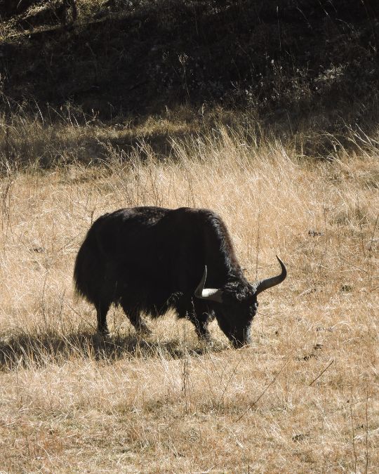
The Langtang Yak Cheese Factory
In 1953, the Nepalese government opened the Langtang Cheese Factory in the high-altitude village of Kyanjin Gompa. This historic factory serves as a massive economic engine for the local herders.
The factory buys fresh yak milk directly from the farmers every single day. Workers then use this milk to produce thousands of kilograms of hard, Swiss-style cheese each year. The demand for local cheese is so high that it sells out quickly after production. Because the factory operates locally, every purchase keeps money directly inside the Langtang economy.
Culture of Langtang Valley
The Tamang Heritage
The local Tamang people share a direct, 500-year-old historical connection with ancient Tibet. Early settlers crossed the high Himalayan border and brought deep highland traditions directly into the valley. Today, the community still speaks a specific Tibeto-Burman dialect. Families keep these ancient cultural roots alive by wearing traditional woven clothing, practicing ancestral farming methods, and sharing oral histories across generations.
Tibetan Buddhism
The residents of the valley strictly practice Tibetan Buddhism. The famous Kyanjin Gompa monastery serves as the central spiritual heart for the entire region. Deep Buddhist philosophy actively guides the daily lives and decisions of the local people. Because this religion teaches profound respect for all living things, the community naturally protects the surrounding forests, wild animals, and fresh mountain rivers from harm.

Daily Rituals
Physical religious objects line the main walking trails throughout the entire valley. Visitors constantly encounter large, spinning prayer wheels and long Mani walls built from intricately carved stones. A cultural norm requires all walkers to pass on the left side of these Mani walls and Buddhist stupas. Following this clockwise direction shows proper respect for the local faith and honors the spiritual energy of the mountains.
Traditional Food
A highly specific traditional diet powers the daily lives of the mountain families. The local menu relies heavily on roasted barley flour, locally known as Tsampa, and warm, salty yak butter tea. Families mix the dry Tsampa directly into the hot butter tea to create a thick, high-energy paste. Eating this dense, warm meal helps the locals survive the freezing mountain climate and provides steady fuel for hard physical work. Nowadays, trekkers can also find international cuisine in the Langtang Valley teahouses menus.
Village Architecture
Traditionally, local builders designed mountain houses specifically to withstand the harsh alpine weather. These historic homes featured thick rock walls, heavy flat slate roofs, and beautifully detailed wooden porches. The thick stone construction successfully trapped heat inside during freezing winters, while the heavy roofs safely held the weight of massive winter snowfalls.
Today, rapid modernization has completely changed the local building style. Modern families now construct strong concrete houses instead of traditional stone huts. Local builders use reinforced steel, imported cement, and bright corrugated metal roofs to rebuild the villages.
Local Festivals
The community celebrates several vibrant holidays throughout the calendar year. The most important local festival is Sonam Lhosar, which marks the traditional Tamang New Year. During this joyous celebration, families wear colorful traditional clothing, perform ancient folk singing, and share special festival meals. These large gatherings strengthen community bonds and successfully pass important cultural history down to the younger children.
Access to Langtang Valley
The Main Route: Driving from Kathmandu to Syabrubesi
The primary entry point into the Langtang Valley is the mountain town of Syabrubesi. Because the region has no local airports, all visitors must travel by road from Nepal’s capital city, Kathmandu. The drive covers exactly 122 kilometers along the Pasang Lhamu Highway. Depending on daily traffic and weather, this overland journey takes between 6 and 9 hours. The road directly connects the busy city streets of Kathmandu to the quiet river gorge of Syabrubesi, which sits at an elevation of 1,460 meters.
Transportation Options: Choosing Buses or Private Jeeps
Travelers access the valley using two main types of vehicles. Local transport companies operate large public buses that leave Kathmandu early every morning. These buses provide the cheapest travel option, but they take longer because the drivers make frequent stops to pick up local passengers and heavy cargo.
Alternatively, visitors hire private four-wheel-drive (4WD) jeeps. These strong vehicles easily cut the travel time down to 5 or 6 hours. Private jeeps provide high ground clearance, which helps the vehicle safely cross rough rocks and deep mud. Hiring a private jeep allows passengers to travel comfortably and skip the crowded public bus terminals.
Road Conditions: Navigating the Mountain Highway
The physical condition of the road changes drastically during the 122-kilometer drive. Over 70% of the road features a smooth, paved road that allows vehicles to move quickly. However, in some sections, the highway turns into a narrow, unpaved dirt track.
Seasonal Impact: Timing the Mountain Drive
The seasonal weather directly controls the safety and speed of the journey. During the heavy summer monsoon (June to September), massive rainstorms frequently wash out sections of the unpaved road. These sudden mudslides can force vehicles to stop for several hours while local road crews clear the heavy rock and mud.
In contrast, the dry autumn and spring months provide highly stable travel conditions. During these clear seasons, the dirt roads harden completely, allowing the vehicle tires to grip the ground safely. Traveling during these dry months ensures a smooth, uninterrupted drive into the Langtang region.
Helicopter Flights: Bypassing the Mountain Roads
Private aviation companies operate direct helicopter flights into the Langtang Valley. These fast flights provide a critical alternative to the long 122-kilometer overland drive.
The helicopters leave directly from Kathmandu and land safely at the high-altitude helipad in Kyanjin Gompa or Syabrubesi. This direct air route takes only 30 to 40 minutes to complete. By flying straight over the steep northern mountain ridges, passengers completely avoid the rough, unpaved dirt roads and the dangerous landslide zones.
These aircraft serve several vital functions for the isolated region. A standard mountain helicopter carries up to 5 passengers or an equal weight of heavy cargo. Because the high valley lacks a local hospital, these helicopters perform fast emergency medical rescues. They also deliver essential building supplies to the villages and provide rapid transport for visitors who cannot endure the difficult 6-hour jeep journey.
Biodiversity of Langtang Valley: A Vertical Ecosystem
The Langtang Valley contains a diverse biological profile due to its extreme altitudinal range, which spans from subtropical forests at 1,460 meters to the high-alpine nival zone above 5,000 meters. As a primary component of Langtang National Park, the valley serves as a critical corridor for rare Himalayan species and high-altitude flora.
Floral Diversity and Forest Zones
The vegetation in the valley follows a strict vertical zonation determined by temperature and moisture levels. In the lower regions around Syabrubesi and Bamboo, dense subtropical forests consist of Chir pine (Pinus roxburghii) and various species of oak. As the elevation increases toward Lama Hotel, the canopy shifts into a temperate zone dominated by hemlock, maple, and several species of rhododendron.
Above 3,000 meters, the landscape transitions into sub-alpine forests where silver fir and birch thrive. Once the terrain surpasses the tree line near Langtang Village (3,430 meters), the forests give way to alpine scrub and meadows. These high-altitude pastures are home to specialized medicinal plants and perennial herbs like Primula and Gentiana, which have adapted to thin air and high ultraviolet exposure.
Wildlife and Avian Species
The valley provides a protected habitat for several endangered mammals. The red panda (Ailurus fulgens) inhabits the dense bamboo thickets between 2,200 and 4,800 meters, relying on the understory for food and nesting. Other significant mammals include the Himalayan black bear, the snow leopard, and the musk deer. Large herds of Himalayan tahr (a mountain goat-like ungulate) are frequently observed on the steep rocky cliffs above the river gorge.

Ornithologists identify the Langtang Valley as a vital bird area, with over 250 recorded species. The diverse forest layers support colorful avian life, including the Himalayan Monal (Nepal’s national bird), the Blood Pheasant, and the Satyr Tragopan. High-altitude raptors, such as the Bearded Vulture (Lammergeier) and the Himalayan Griffon, use the valley’s powerful thermal updrafts to hunt across the alpine ridges.
Langtang Valley For Trekking
The standard Langtang Valley trek covers exactly 39 kilometers of continuous mountain trails, often serving as the central link between the Gosaikunda lake region to the south and the Tamang Heritage Trail to the west. Trekkers start the physical journey at an elevation of 1,460 meters in the town of Syabrubesi, which acts as the shared junction for all three trekking routes. Over several days, hikers walk up the river gorge to reach the final village of Kyanjin Gompa at 3,870 meters. This gradual, steady elevation gain allows the human body to acclimatize safely to the thinning mountain air before attempting the higher 4,610-meter Lauribina Pass toward Gosaikunda. Most visitors complete this primary Langtang route in 8 days, depending entirely on their daily walking speed and whether they choose to extend their journey into the neighboring Tamang cultural circuits.

Discover Langtang Trek itineraries for every skill level from beginners to frequent high altitude trekkers. From 4-day highlights for beginners to 14-day circuits for experts, find the route that best fits your journey.
Conclusion: The Evolving Reality of the Langtang Valley
The Langtang Valley remains a high-altitude landscape defined by its 15th-century Tibetan origins and its dramatic 5,700-meter elevation rise from Syabrubesi to the peak of Langtang Lirung. This geographical intensity dictates every aspect of local life, from the cold-weather agriculture of the high pastures to the 1953 establishment of the Langtang Cheese Factory. While the 2015 earthquake permanently altered the valley’s physical appearance, the present-day reality is one of successful recovery, featuring modern concrete settlements that sit safely above the historic avalanche zones.
As climate change shifts the traditional monsoon and autumn seasons, understanding the valley’s atmospheric patterns has become essential for safe visitation. Today, the local economy successfully balances traditional yak herding with modern hospitality, fueled by a 122-kilometer road link to Kathmandu and rapid helicopter access for essential supplies. By respecting the Buddhist rituals, Tamang language, and fragile alpine ecosystem, visitors help preserve the Langtang Valley as a thriving center of Himalayan culture and biodiversity.