New Langtang Trek Map with Distance, Elevation and Villages
The map of the Langtang Valley Trek illustrates the villages, towns, and settlements within the valley, along with the distances between them. It highlights the elevation of key landmarks and mountains, providing clear directions and the best route to complete the trek, as per your preference.
We have updated our Langtang Valley Trek map and itinerary following the Bhotekoshi flood. The trek now starts and ends at Thulosyabru instead of Syabrubesi, and yes it is possible to do Langtang valley trek now. We have also made the same changes to the maps below. For more details, please see our latest Langtang Valley Trek update.
Interactive Langtang Valley Trek Map (Google Map Integration)
You can use the map below just like you would use Google Maps. It is fully interactive!
We have created an interactive Langtang Trek map using the Google Maps interface to make navigation as easy as possible. This is the best Langtang Valley map format, allowing you to interact with the route in real-time.
See the 8-Day Langtang Itinerary Here
| Day | Route (Start → Destination) | Activity | Elevation (Altitude) |
|---|---|---|---|
| 1 | Kathmandu → Thulosyabru | Drive | Thulosyabru – approx. 2,210 m / 7,250 ft |
| 2 | Thulosyabru → Lama Hotel | Trek | Lama Hotel – approx. 2,470 m / 8,103 ft |
| 3 | Lama Hotel → Langtang Village | Trek | Langtang Village – approx. 3,430 m / 11,253 ft |
| 4 | Langtang Village → Kyanjin Gompa | Trek | Kyanjin Gompa – approx. 3,830 m / 12,565 ft |
| 5 | Kyanjin Gompa ↔ Kyanjin Ri / Tserko Ri | Hike and Return | Kyanjin Ri 4,773 m (15,659 ft) / Tserko Ri 4,984 m (16,351 ft) |
| 6 | Kyanjin Gompa → Lama Hotel | Trek (descent) | Lama Hotel – approx. 2,470 m / 8,103 ft |
| 7 | Lama Hotel → Thulosyabru | Trek | Thulosyabru – approx. 2,210 m / 7,250 ft |
| 8 | Thulosyabru → Kathmandu | Drive | Kathmandu – approx. 1,400 m / 4,600 ft |

Langtang Valley Trek Map Image Format
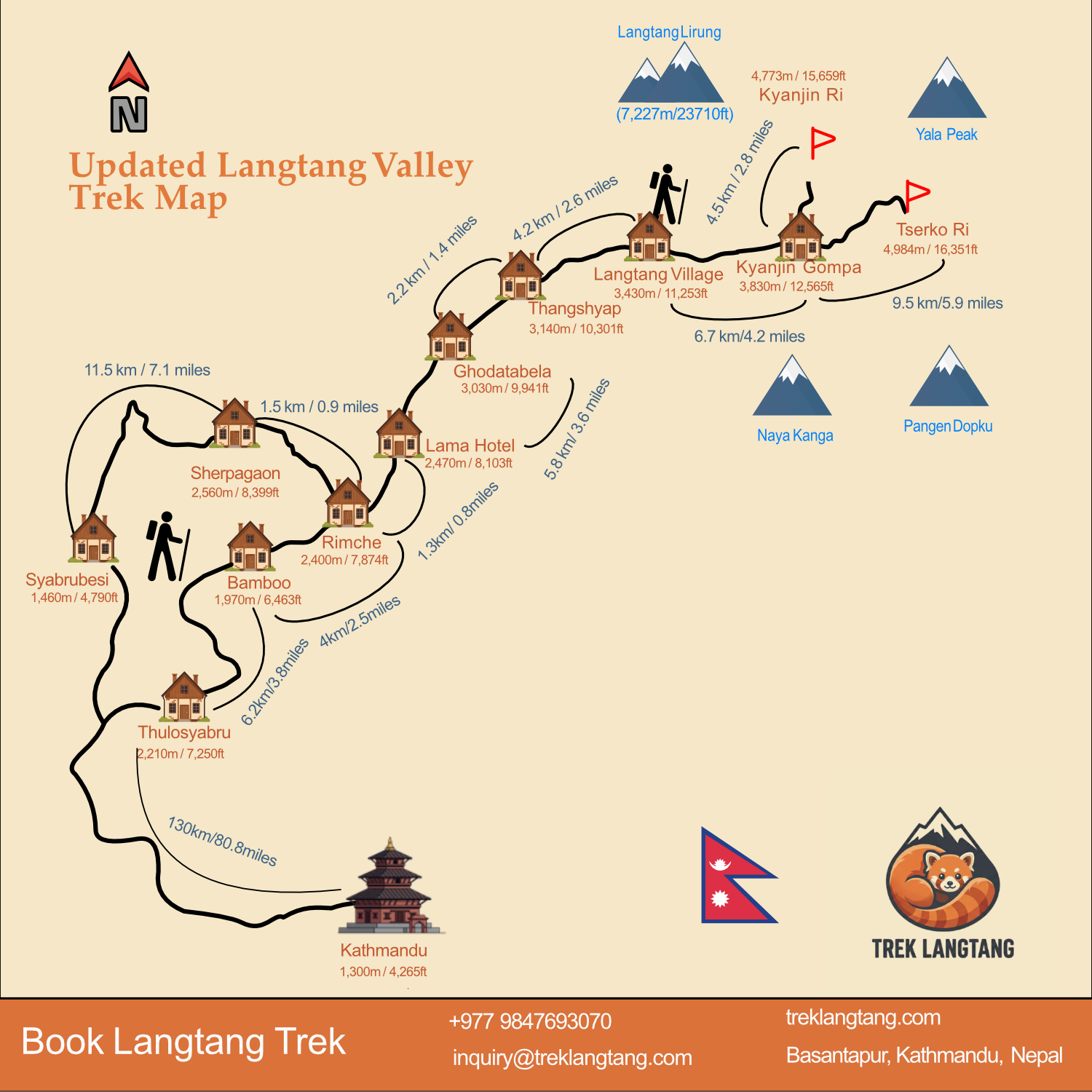
The map above provides a clear visual overview of the entire Langtang Valley Trek route, including major villages, elevation points, and trail directions. It highlights the journey from Thulosyabru to Kyanjin Gompa, marking key stops, side-trip routes, viewpoints, and terrain changes to help trekkers plan confidently.
PDF of Langtang Valley Trek Map
Trekkers are free to download this Langtang trek map PDF and use it during their trek. If you are viewing this on a mobile device and the map is not appearing, please click the “Langtang Trek Map” link located directly next to the Download button.
The Langtang trekking map (image and PDF) above helps in itinerary planning, as it mentions daily walking distances, elevation gains, and village locations. The altitudes are listed in both meters and feet, so the map helps you monitor your ascent and prevent altitude sickness.
We typically recommend that trekkers purchase a physical paper map before starting the hike. This ensures you have a reliable resource that works regardless of battery life of your phone or signal strength.
Langtang Trek Distance and Duration
This Langtang Trek table lists the exact distance and walking time for every trail section. It connects the paths shown on the map above to the actual hours you will spend hiking. Trekkers use these numbers to plan where to start and end their day. By checking these distances against the map, you can see how far villages like Lama Hotel, Kyanjin Gompa, Syabrubesi are from your current location.
| From | To | Distance (km) | Distance (miles) | Approx. Time |
|---|---|---|---|---|
| Thulosyabru | Bamboo | 6.2 km | 3.8 miles | 3.5 hrs |
| Bamboo | Rimche | 4.0 km | 2.5 miles | 2 hrs |
| Rimche | Lama Hotel | 1.3 km | 0.8 miles | 30-45 mins |
| Lama Hotel | Ghodatabela | 5.8 km | 3.6 miles | 3 hrs |
| Ghodatabela | Thangshyap | 2.2 km | 1.4 miles | 1 hr |
| Thangshyap | Langtang Village | 4.2 km | 2.6 miles | 1.5 – 2 hrs |
| Langtang Village | Kyanjin Gompa | 6.7 km | 4.2 miles | 3-4 hrs |
| Kyanjin Gompa | Kyanjin Ri | 4-5 km* | 2.5-3.1 miles | 3-4 hrs |
| Kyanjin Gompa | Tserko Ri | 9-10 km* | 5.6-6.2 miles | 6-8 hrs |
These distances help you plan side trips to high peaks like Kyanjin Ri and Tserko Ri. While the map shows the way, this table explains how much time you need for steep climbs. Use these walking times to set your daily pace and make sure you reach Kyanjin Gompa before dark. These facts ensure your schedule matches the real trail conditions in the Langtang Valley.
Langtang Valley Altitude (Villages and Landmarks)
This Langtang Valley altitude table lists the exact height of every major village and landmark along the trail. It helps trekkers monitor their climb from Syabrubesi at 1,460 meters to the high peaks above Kyanjin Gompa. By comparing these numbers with the map provided above, you can identify where the trail gets steeper and plan your rest stops to avoid altitude sickness.
| Landmark | Altitude (m/ft) |
|---|---|
| Syabrubesi | 1,460m / 4,790ft |
| Thulosyabru | 2,210 meters / 7,250 feet |
| Bamboo | 1,970m / 6,463ft |
| Sherpagaun | 2,560m / 8,399ft |
| Rimche | 2,400m / 7,874ft |
| Lama Hotel | 2,470m / 8,103ft |
| Ghodatabela | 3,030m / 9,941ft |
| Thangshyap | 3,140m / 10,301ft |
| Langtang Village | 3,430m / 11,253ft |
| Kyanjin Gompa | 3,830m / 12,565ft |
| Kyanjin Ri | 4,773m / 15,659ft |
| Tserko Ri | 4,984m / 16,351ft |
These elevation measurements guide your pace as you move from the low river valleys to the high Himalayan peaks like Tserko Ri. Use these specific heights to schedule your acclimatization days and ensure a safe trek through the varying terrain of Langtang National Park.
Geographic Map of Langtang Valley
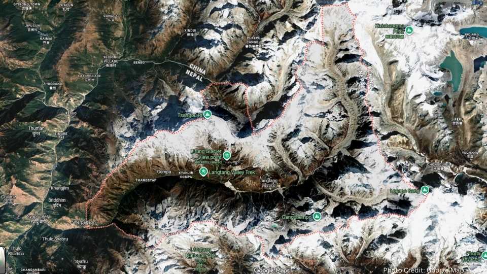
This geographic view shows the deep glacial valley of Langtang, located within the Rasuwa District of Nepal. It highlights the natural border formed by the high Himalayan peaks to the north and the steep, forested ridges to the south. Trekkers use this perspective to see how the Langtang Khola river carves a path through the landscape, creating the primary route from the lowlands toward the Tibetan border.
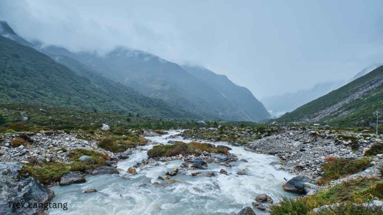
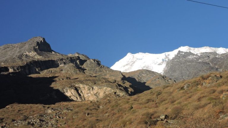
Our Langtang Valley photo gallery shares real trail pictures so you can see the exact mountain views waiting for you. It will also give an idea about the geographical beauty of Langtang Valley.
Key Geographic Features
- Glacial Valley Floor: The main trekking trail follows this U-shaped valley, which was formed by ancient glaciers moving toward the lower elevations.
- The Langtang Lirung Massif: Standing at 7,227m, this dominant granite peak creates a massive rain shadow and dictates the local weather patterns.
- Hydrology (River Systems): The Langtang Khola acts as the central drainage for the surrounding glaciers, flowing west to join the Bhote Koshi river.
- Vertical Climate Zones: The terrain shifts from sub-tropical forests near Syabrubesi to alpine tundra and permanent snowfields near the valley head.
Terrain Features and Trail Conditions on the Map
Maps typically highlight three distinct terrain zones:
- Lower Valley: Dense forests, suspension bridges, and riverbanks. Trails are shaded and moderately steep.
- Mid Valley: Open meadows, wider trails, and clearer mountain views. Terrain becomes gentler and more stable.
- Upper Valley: Rocky moraines, glacial plains, and exposed ridges near Kyanjin Gompa. Conditions vary with weather but remain non-technical.
These terrain details explain why the Langtang trek involves such a dramatic change in environment over a short distance. While the trail map shows where to walk, this geographic view reveals the massive scale of the rock walls and ice fields that surround the path. Use this bird’s-eye view to prepare for the high-altitude environment of the upper Langtang region.
Final Words
We hope our detailed Langtang Valley Trek resources, including the image, interactive map, and PDF, have been helpful to you. You can download the PDF or image versions for offline use. Additionally, the interactive Google Map is a great tool for analyzing the route in detail by zooming in on specific sections.
This Langtang map is an essential tool for:
- Planning the duration of your trek and selecting overnight stays for each day.
- Identifying elevation changes to manage the risk of altitude sickness and plan for acclimatization.
- Tracking daily distances and identifying upcoming villages and landmarks.
- Recognizing the stunning mountain peaks surrounding the valley.
The topographical map of the Langtang Valley shows steep river gorges, open meadows, rocky moraines, and panoramic Himalayan peaks.
Let the map guide your steps through the Langtang Valley.