Comparing the Langtang Valley Trek and the Annapurna Circuit Trek
In the Nepal trekking industry, choosing the right trail requires aligning your physical capability, budget, and timeline with specific route profiles. The Langtang Valley Trek and the Annapurna Circuit Trek (ACT) represent two vastly different Himalayan experiences catering to distinct trekker archetypes.
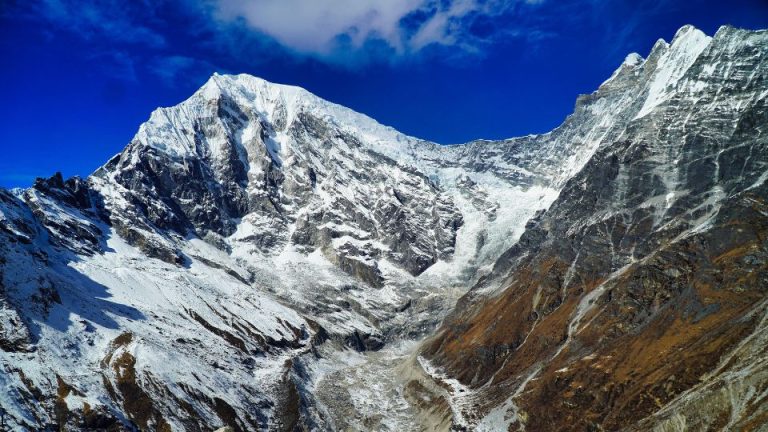
The Langtang Valley Trek is an 8-day, 75-kilometer out-and-back journey located 122 kilometers from Kathmandu. Trekkers navigate moderate, gradual ascents through subtropical forests to reach alpine glacier valleys. This route limits mandatory sleeping elevations to 3,870 meters at Kyanjin Gompa, which keeps the Acute Mountain Sickness (AMS) risk moderate. Cultural enthusiasts choose the Langtang Valley Trek to experience quiet trails, close-up views of Langtang Lirung, and authentic Tamang Tibetan Buddhist traditions for a highly accessible budget of $300 to $600 USD.
Unlike the linear Langtang route, the Annapurna Circuit Trek is a 14-day, 230-kilometer strenuous circular loop. Hikers tackle the challenging 5,416-meter Thorong La Pass, a geographical highlight that introduces a high risk of AMS and mandates strict acclimatization days. The Annapurna Circuit rewards milestone-seekers with panoramic views of the Annapurna Massif and transitions through extreme climate zones—from lush Gurung lowlands to the arid trans-Himalayan desert. Because of its longer duration, multiregional transport logistics, and premium lodge infrastructure, the ACT requires a higher budget of $800 to $1,200+ USD.
Analyze the comprehensive data table below to match your physical endurance and route preferences with the specific demands of these two iconic routes.
| Differences | Langtang Valley Trek | Annapurna Circuit Trek (ACT) |
|---|---|---|
| Route Profile | Out-and-back linear valley route | Full circular loop (though often shortened by taking transport on the new road networks) |
| Total Trek Duration | 8 days | 14 days (highly dependent on where you start/end using the road) |
| Total Trekking Distance | ~65 to 75 km | ~160 to 230 km |
| Maximum Altitude Reached | 3,870m (Kyanjin Gompa), 4770m(optional Kyanjin Ri hike) or 4,985m (optional Tserko Ri hike) | 5,416m (Thorong La Pass) |
| Overall Difficulty and Physical Demand | Moderate (gradual ascents, shorter daily distances) | Strenuous (long duration, high altitude pass crossing, variable terrain) |
| Risk of Acute Mountain Sickness (AMS) | Moderate (forgiving elevation profile, sleeping below 4,000m) | High (requires crossing a 5,400m+ pass; strict acclimatization days are mandatory) |
| Climate Zones and Topographical Diversity Traversed | Subtropical forest to alpine glacier valley | Subtropical terraced farms, dense pine forests, alpine zones, and arid trans-Himalayan desert (rain shadow) |
| Proximity to Kathmandu | ~122 km to the trailhead at Syabrubesi | ~170 km to the traditional starting point at Besisahar |
| Transport Type to Trailhead and Ending Point | Bus or jeep to and from Syabrubesi (same start and end point) | Bus/jeep to Besisahar/Chame; return via jeep/flight from Jomsom or bus from Pokhara |
| Peak Visibility and Proximity to Mountain Ranges | Close-up valley views of Langtang Lirung, Dorje Lakpa, and Gangchenpo | Panoramic views of the Annapurna Massif (I-IV), Dhaulagiri, Manaslu, and Gangapurna |
| Primary Geographical Highlights | Deep alpine valley, Langtang River, surrounding glaciers | Thorong La Pass, Kali Gandaki Gorge (deepest in the world), arid Mustang-like landscapes |
| Dominant Ethnic Groups | Primarily Tamang people with Tibetan Buddhist traditions | Gurung in the lower hills, Manangi in the high valleys, Thakali in the Kali Gandaki gorge |
| Trekker Traffic and Crowd Density | Low to moderate; generally quiet and peaceful | High; a historically famous and globally popular trekking route |
| Overall Trail Atmosphere and Vibe | Culturally immersive, spiritually quiet, raw nature focus | Diverse, physically challenging, transitioning from lush Hindu lowlands to arid Buddhist highlands |
| Infrastructure and Teahouse Accommodation Quality | Well-established, cozy, newly rebuilt traditional teahouses | Highly developed; ranges from basic teahouses to premium lodges with luxury amenities in major hubs |
| Food Variety and Dining Amenities | Traditional local menus, heavily featuring Dal Bhat and fresh yak cheese | Extensive international menus (pizza, pasta, burgers) and famous bakeries (“Apple Pie Trail”) |
| Internet and Mobile Connectivity Range | Patchy mobile network; paid Wi-Fi available in some teahouses | Widespread mobile network and Wi-Fi, available in almost all villages and even high camps |
| Electricity Access and Device Charging Costs | Mostly solar-powered; free or cheap charging at lower elevations | Reliable hydropower in most villages; paid device charging at higher elevations |
| Total Estimated Budget/Cost | Lower (~$300 – $600 USD) | Higher (~$800 – $1,200+ USD, factoring in longer duration and varied transport) |
| Required Trekking Permits | TIMS Card, Langtang National Park Entry Permit | TIMS Card, Annapurna Conservation Area Project (ACAP) Permit |
| Best Seasons and Specific Weather Risks | Spring/Autumn; generally stable, historical avalanche risk near Langtang village | Spring/Autumn; Thorong La Pass is susceptible to blockages from heavy snowstorms |
| Availability of Major Side Trips | Tserko Ri, Kyanjin Ri, Langshisha Kharka | Tilicho Lake (one of the world’s highest lakes), Ice Lake, Poon Hill |
Selecting the ideal Himalayan route depends strictly on your timeframe, altitude tolerance, and physical conditioning.
The 8-day Langtang Valley Trek offers time-conscious travelers and cultural enthusiasts a highly accessible, budget-friendly route. Trekkers navigate moderate, gradual ascents to experience authentic Tamang culture and close-up views of Langtang Lirung for under $600 USD. Because the highest mandatory sleeping elevation remains below 4,000 meters, this linear valley route presents a manageable risk of Acute Mountain Sickness (AMS).
Conversely, the 14-day Annapurna Circuit Trek challenges experienced hikers with the strenuous 5,416-meter Thorong La Pass. This $800+ USD multiregional loop rewards milestone-seekers with panoramic views of the Annapurna Massif and transitions through extreme trans-Himalayan climate zones. The high altitude and variable terrain demand strict acclimatization schedules and high physical endurance.
Match your physical capability and budget to these specific route profiles to ensure a safe, rewarding Nepal trekking experience.