Langtang National Park, Nepal
Table of Contents
Overview of Langtang National Park
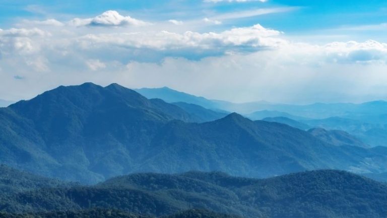
Established in 1976 as Nepal’s first Himalayan protected area, Langtang National Park encompasses 1,710 square kilometers of extreme vertical topography situated precisely 32 kilometers north of Kathmandu. The national park forms a formidable natural boundary with the Tibetan Plateau, rising aggressively from the 1,000-meter sub-tropical basins of the Bhote Koshi river to the permanent ice fields anchoring the 7,227-meter summit of Langtang Lirung. This continuous 6,000-meter elevation gradient generates distinct bioclimatic zones that physically sustain over 70 active glaciers, dense broadleaf canopies, and critical high-altitude freshwater systems like the sacred Gosainkunda lakes.
The Langtang National Park’s steep geographical structure shelters a dense concentration of rare Himalayan flora and fauna distributed across its steep altitudinal tiers. Conservationists actively protect critical habitats within the temperate bamboo forests that support one of Nepal’s highest populations of endangered red pandas (Ailurus fulgens), while the exposed alpine zones sustain elusive snow leopards (Panthera uncia) and transhumant yak herds. Beyond ecological observation, trekkers utilize the park’s diverse network of trails to access high-altitude vantage points like Tserko Ri (4,984 meters) to secure continuous, 360-degree views of the Dorje Lakpa and Langshisha Ri mountain ranges.

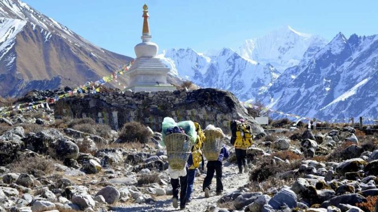
Beyond its physical and biological assets, Langtang National Park functions as a living sanctuary for centuries-old Tibetan Buddhist heritage and indigenous Tamang culture. Expeditions along established routes like the Tamang Heritage Trail or the Classic Langtang Valley Traverse successfully integrate physical acclimatization with community-run homestays, traditional agricultural practices, and active monastic centers like Kyanjin Gompa (3,870 meters). Despite the catastrophic 2015 earthquake that devastated the original valley infrastructure, local residents have completely rebuilt the settlements using resilient engineering, decisively restoring the region’s status as a premier destination for ecological tourism, technical mountaineering, and spiritual pilgrimage.
Where is Langtang National Park Located?
Langtang National Park occupies a central position in the High Himalayas of Nepal, situated approximately 32 kilometers north of Kathmandu. The park’s northern boundary follows the international border with Tibet (China). Administratively, the park’s 1,710 square kilometers extend across three districts of Nepal: Rasuwa, Nuwakot, and Sindupalchowk.
What is Langtang National Park Elevation?
The elevation of Langtang National Park varies drastically, ranging from a minimum of 1,000 meters (3,280 feet) at the lower tropical regions of the Bhote Koshi river to a maximum altitude of 7,227 meters (23,710 feet) at the summit of Langtang Lirung. This vertical rise of over 6,000 meters creates distinct bioclimatic zones, transitioning from deciduous forests to permanent ice and rock.
What is the Area of Langtang National Park?
Langtang National Park covers a total area of 1,710 square kilometers (660 square miles). Additionally, the government manages a surrounding buffer zone of 420 square kilometers (162 square miles), where community-based conservation and sustainable resource management prioritize the coexistence of local residents and wildlife.
How to reach Langtang National Park?
Visitors reach Langtang National Park primarily via a 6 to 9-hour drive from Kathmandu to Syabrubesi or Dhunche, the main gateway villages for trekking. This drive follows the Pasang Lhamu Highway through Trishuli using local buses or private four-wheel-drive vehicles. While no domestic airports serve the park directly, the trailhead at Syabrubesi and Dhunche provides immediate access to the Langtang Valley trail, the Gosainkunda trek, Tamang Heritage Trek, and the Helambu circuit.
What are the Attractions in Langtang National Park?
Langtang National Park offers trekkers and researchers a dense concentration of Himalayan attractions, ranging from high-altitude glacial lakes to endangered wildlife habitats. The park combines indigenous cultural heritage with active alpine ecosystems, making it a primary destination for ecological tourism, mountaineering, and spiritual pilgrimage in central Nepal.
- Red Panda Habitat: Langtang National Park protects one of Nepal’s highest concentrations of the endangered red panda (Ailurus fulgens). Conservationists, trekkers, and Red Panda tracking travelers observe these elusive mammals navigating the dense bamboo understories within the park’s temperate forest zones.
- Kyanjin Gompa: This ancient Tibetan Buddhist monastery sits at an elevation of 3,830 meters (12,565 feet), functioning as the spiritual center of the upper Langtang Valley. Monks perform daily rituals here, providing visitors with a direct connection to centuries-old Himalayan religious traditions.
- Tserko Ri: Trekkers ascend Tserko Ri (peak/hill) to a maximum altitude of 4,984 meters (16,351 feet) to secure unobstructed panoramic views of the Langtang Himalayas. This challenging acclimatization hike rewards climbers with direct sightlines to the Langtang Lirung peak and its surrounding glacial basins.
- Kyanjin Ri: Kyanjin Ri (peak/hill) serves as a highly accessible viewpoint at 4,773 meters (15,659 feet), located directly above the Kyanjin Gompa settlement. The steep two-hour ascent delivers immediate visual access to the active Langtang Lirung glacier and the valley floor below.
- Yala Peak Climbing: Mountaineers utilize Yala Peak (5,520 meters / 18,110 feet) as a premier introductory trekking peak within the Langtang region. The non-technical ascent provides novice climbers with essential alpine experience and summits overlooking the Shishapangma mountain range in Tibet.
- Rhododendron Blooming in Spring Season: Between March and May, the park’s sub-alpine forests erupt into vibrant red, pink, and white rhododendron blossoms. This seasonal bloom transforms the lower trekking trails, attracting botanists and nature photographers to the region’s dense floral ecosystems.
- Tamang Culture: Indigenous Tamang communities inhabit the Langtang region, preserving distinct Tibetan-influenced dialects, architecture, and agricultural practices. Visitors experience this living heritage through community homestays, traditional festivals, and localized wood-carving crafts.
- 360-Degree Mountain Views: High-altitude vantage points throughout the valley provide trekkers with beautiful, continuous, 360-degree exposure to major Himalayan peaks. These panoramas encompass Langtang Lirung, Dorje Lakpa, and Langshisha Ri, anchoring the visual experience of the entire trekking route.
- Gosaikunda: The sacred alpine freshwater lake of Gosaikunda sits at 4,380 meters (14,370 feet), functioning as a major pilgrimage site. According to Hindu texts, Lord Shiva created the lake with his trident to extract water, drawing thousands of devotees traversing the rugged trails every August during the Janai Purnima festival to bathe in its holy waters.
- Glaciers: Active Himalayan glaciers, including the massive Langtang Lirung Glacier, dominate the upper reaches of the national park. These dynamic ice formations shape the valley’s topography and supply the critical meltwater that feeds the Trisuli River system downstream.
- Sub-Alpine and Alpine Meadows: Above the tree line, expansive alpine meadows known as ‘kharkas’ support a specialized ecosystem of high-altitude flora. Local herders utilize these nutrient-rich grazing lands during the summer months to sustain their transhumant yak herds.
- Yak Cheese Factory: The Kyanjin Gompa Yak Cheese Factory, established in 1955 with Swiss assistance, produces high-quality, artisanal cheese for the region. Trekkers consume this locally manufactured, nutrient-dense protein source to sustain their energy levels during high-altitude acclimatization.

The Geography of Lantang National Park
Topography of Langtang National Park
The topography of Langtang National Park spans a massive vertical range, beginning at 1,000 meters (3,280 feet) along the southern river valleys and peaking at 7,227 meters (23,710 feet) at the summit of Langtang Lirung.River forces actively shape the park’s lower and middle elevations. The Bhote Koshi and Trishuli rivers carve deep, V-shaped gorges along the western boundary. In the park’s center, the Langtang Khola cuts directly through the mountains to form the Langtang Valley.
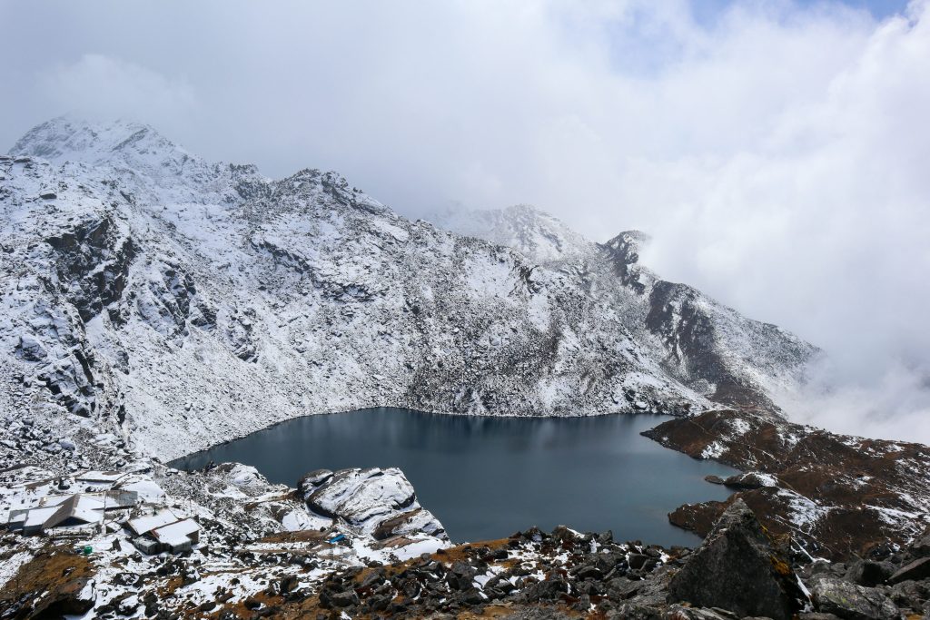
Over 70 active glaciers dominate the upper regions of the Langtang National Park. Massive ice bodies, including the Langtang Lirung and Yala glaciers, grind against the mountainsides to deposit extensive rocky moraines and scour out deep alpine basins. These glacial systems supply the meltwater for high-altitude wetlands, most notably the Gosaikunda lake. Sitting at 4,380 meters (14,370 feet), this oligotrophic alpine lake system acts as a critical freshwater reservoir for the downstream regions.
The park is also home to many towering mountains, such as Langtang Lirung, Dorje Lakpa, Mount Yubra, Yala Peak, and Naya Kanga. Langtang Lirung anchors the northern boundary, while the Dorje Lakpa range lies in the eastern terrain. These jagged, snow-covered ridges establish a formidable natural border with the Tibetan Plateau and physically block monsoon currents, dictating the localized weather patterns within the valleys below.
Climate and Weather Patterns
Langtang National Park experiences distinct seasonal shifts, but recent meteorological changes have significantly altered the region’s traditional trekking timelines. Historically, the Himalayas followed a predictable precipitation cycle: the monsoon lasted from June to early September, autumn spanned mid-September to November, winter covered December to February, and spring occurred from March to May.
However, the 2026 climate pattern demonstrates a clear seasonal delay. The monsoon season now extends from mid-June until October 5, delivering heavy precipitation and cloud cover weeks later than the historical average. This extended rainfall pushes the clear autumn weather window to a later October 5 through December 20 timeframe. Winter conditions consequently shift to a delayed December 20 start, lasting through February.
Best Time to Visit Langtang National Park
The most suitable months to trek the Langtang Valley in 2026 are October 5 to December 20 and March to May. These specific periods align with the newly stabilized weather patterns inside Langtang National Park, ensuring clear mountain visibility, firm trail conditions, and reduced precipitation risks.
Trekkers planning an autumn trekking must adjust their itineraries to begin after October 5 to avoid the extended 2026 monsoon rains and potential landslide hazards. This shifted autumn window provides crisp air and optimal panoramic views of the Langtang Himalayas. Alternatively, the spring window (March to May) provides a reliable secondary trekking season, characterized by moderate daytime temperatures and the active blooming of rhododendron forests across the sub-alpine zones. By scheduling trekking strictly within these two timeframes, visitors maximize safety, visibility, and overall trekking success.
Langtang National Park Map
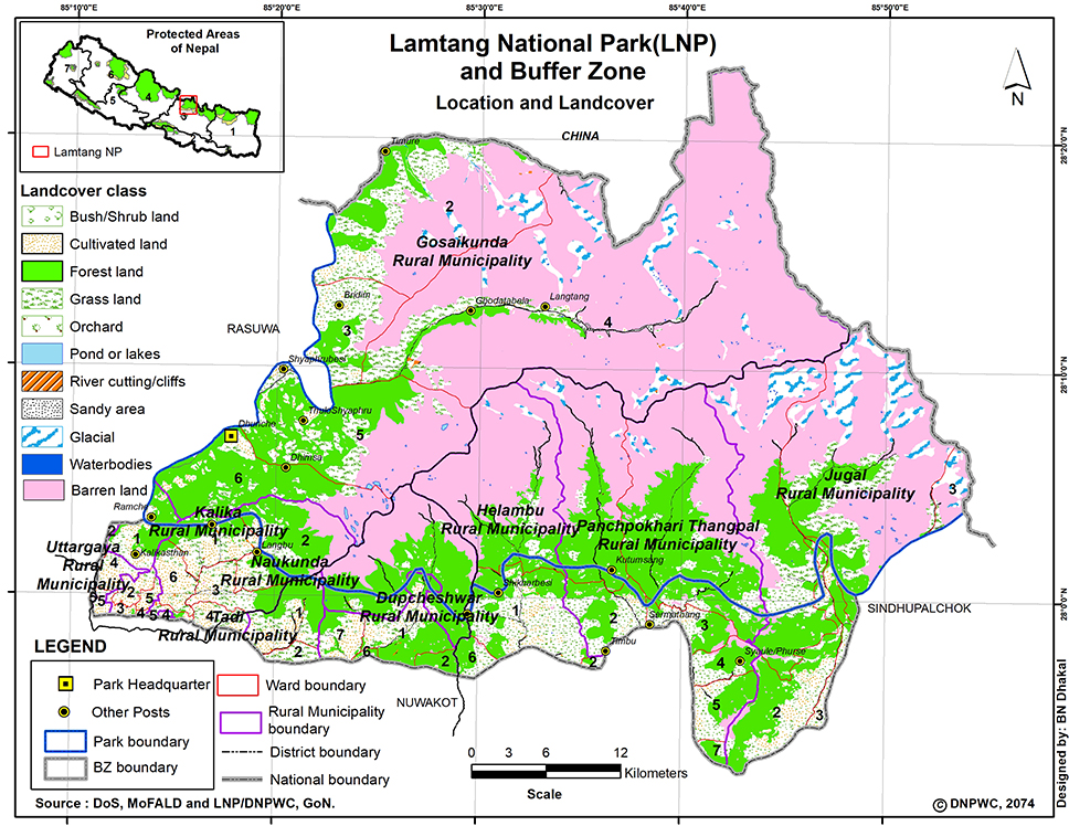
The Langtang National Park map visually defines the 1,710-square-kilometer protected area, highlighting the primary trekking corridors, mountains, forests, rivers, and indigenous villages. The visual guide organizes the region’s complex topography from the river gorges at 1,000 meters to the permanent ice fields above 7,000 meters to help visitors rapidly comprehend the terrain and its intersecting ecosystems.
Map of Langtang National Park
Mountains in Langtang National Park
Langtang National Park encompasses 68 named Himalayan peaks that establish a formidable natural border with the Tibetan Plateau. Many of these mountains can be seen during Langtang Valley Trek. These towering summits dictate the region’s glacial activity, anchor the primary trekking routes, and provide world-class climbing objectives for international mountaineers. Some of the popular mountains in Langtang National Park are as follows:
- Langtang Lirung (7,227 meters / 23,711 feet)
- Dorje Lakpa (6,966 meters / 22,854 feet)
- Langtang Ri (7,205 meters / 23,638 feet)
- Yala Peak (5,520 meters / 18,110 feet)
- Naya Kanga / Ganja La Peak (5,844 meters / 19,173 feet)
- Loenpo Gang (6,979 meters / 22,897 feet)
- Ganchenpo (6,378 meters / 20,925 feet)
- Langshisha Ri (6,427 meters / 21,085 feet)
- Tsangbu Ri (6,781 meters / 22,247 feet)
- Yansa Tsenji (6,690 meters / 21,950 feet)
- Kyunga Ri (6,601 meters / 21,657 feet)
- Ghenge Liru / Langtang II (6,581 meters / 21,591 feet)
- Dogpache (6,562 meters / 21,529 feet)
- Morimoto Peak (6,150 meters / 20,180 feet)
- Tsogaka (5,846 meters / 19,180 feet)
- Tserko Ri (4,984 meters / 16,351 feet)
- Kyanjin Ri (4,773 meters / 15,659 feet)
- Baden-Powell Scout Peak / Urkema Peak (5,890 meters / 19,324 feet)
- Dorje Lakpa II (6,593 meters / 21,630 feet)
- Gurkarpo Ri (6,891 meters / 22,608 feet)
- Shalbachum (6,918 meters / 22,697 feet)
- Phurba Gyachung (6,637 meters / 21,774 feet)
- Dragmorpa Ri (6,185 meters / 20,291 feet)
- Ponggen Dopchu (5,930 meters / 19,455 feet)
- Bhairab Takura / Madiya (6,799 meters / 22,306 feet)
- Chhopa Bamare (6,060 meters / 19,881 feet)
- Madhya Peak (6,257 meters / 20,528 feet)
- Gyalzen Peak (6,151 meters / 20,180 feet)
- Kanshurum (6,078 meters / 19,940 feet)
- Leonpo Gang East (6,733 meters / 22,089 feet)

Villages and Towns in Langtang National Park
Indigenous Tamang, Sherpa, and Yolmo communities inhabit villages throughout the Langtang National Park’s river valleys and alpine pastures. These villages function as essential logistical hubs, providing trekkers with teahouse accommodations, local food resources, and direct exposure to centuries-old Himalayan Buddhist culture. Some of the popular villages and towns in Langtang National Park are as follows:
- Syabrubesi
- Sherpagaon
- Dhunche
- Langtang Village
- Kyanjin Gompa
- Lama Hotel
- Mundu
- Thulo Syabru
- Briddim
- Gatlang
- Thuman

Municipalities in Langtang National Park
Administratively, Langtang National Park spans three central Nepalese districts: Rasuwa, Nuwakot, and Sindhupalchok. The park area intersects with ten specific rural municipalities (Gaupalikas) that manage the local populations, coordinate buffer-zone conservation efforts, and oversee regional tourism development. Municipalities that lies in Langtang National Park is mentioned below:
- Gosaikunda Rural Municipality
- Kalika Rural Municipality
- Naukunda Rural Municipality
- Uttargaya Rural Municipality
- Tadi Rural Municipality
- Dupcheshwar Rural Municipality
- Suryagadhi Rural Municipality
- Panchpokhari-Thangpal Rural Municipality
- Helambu Rural Municipality
- Jugal Rural Municipality
Rivers in Langtang National park
Powerful Himalayan river systems carve deep gorges through the national park, supplying crucial freshwater downstream and sustaining dense subtropical forests at lower elevations. These waterways originate from high-altitude glacial melt and physically shape the primary valleys used for local transportation and trekking corridors. The most prominent rivers in Lantang National Park are as follows:
- Trishuli River
- Bhote Koshi River
- Langtang Khola
- Sun Koshi River
- Melamchi Khola
Glaciers in Langtang National Park
Active glacial bodies dominate the northern reaches of the park, steadily grinding against the rock faces to carve out the region’s characteristic U-shaped valleys. These immense ice fields act as primary freshwater reservoirs, directly feeding the Langtang Khola and supporting the localized high-altitude ecosystem.
- Langtang Lirung Glacier
- Yala Glacier
- Lirung Glacier
- Shalbachum Glacier
- Langshisha Glacier
- Ghala Glacier
Glacial Lakes in Langtang National Park
High-altitude glacial lakes dot the alpine landscape, serving as critical biological hotspots and profound spiritual destinations. Thousands of Hindu and Buddhist pilgrims travel to these oligotrophic water bodies annually to perform sacred bathing rituals during the Janai Purnima festival.
- Gosaikunda Lake
- Bhairavkunda Lake
- Saraswatikunda Lake
- Suryakunda Lake
- Dudhkunda Lake
- Parvatikunda Lake
- Raktakunda Lake
Biodiversity of Langtang National Park
The vertical topography of Langtang National Park establishes distinct climatic zones that currently shelter 46 mammal species, over 250 bird species, and more than 1,000 vascular plant species. Active conservation protocols of the park protect endangered Himalayan fauna, while the park’s transitioning forests and expansive alpine meadows sustain complex food webs for both apex predators and high-altitude ungulates.
Wildlife in Langtang National Park
The protected area sustains a specialized concentration of Himalayan fauna. Bioclimatic boundaries dictate this species distribution, anchoring tropical primates and small mammals to the lower river valleys while forcing cold-adapted predators and sure-footed mountain goats to navigate the exposed upper crags.
Sub-Tropical Wildlife
Sub-tropical wildlife is found near Syabrubesi and lower altitude of Langtang National Park:
- Rhesus macaques
- Assamese monkeys
- Wild boars
- Barking deer
- Yellow-throated martens
Temperate Wildlife
Temperate wildlife is found around Lama Hotel, Sherpagaon, Thulosyabru:
- Red pandas (Ailurus fulgens)
- Himalayan black bears
- Leopard cats
- Grey langur monkeys
- Himalayan monals (Danphe – Nepal’s national bird)
Sub-Alpine Wildlife
Sub-alpine wildlife is found around Langtang Village and Chandanbari:
- Musk deer
- Himalayan tahr
- Serows
- Ghorals
- Blood pheasants
Alpine Wildlife
Alpine wildlife is found from Kyanjin Gompa and above:
- Snow leopards (Panthera uncia)
- Blue sheep (Bharal)
- Tibetan snowcocks
- Snow partridges
- Himalayan griffons
Vegetation in Langtang National Park
Botanical diversity within the park transitions aggressively from dense broadleaf canopies at the southern borders to resilient dwarf shrubs near the permanent snowlines. Over 1,000 recorded plant species anchor this environment, physically stabilizing the steep mountain soil while supplying critical medicinal herbs and dense foraging materials for the regional wildlife.
Sub-Tropical Vegetation
- Sal trees (Shorea robusta)
- Chir pines (Pinus roxburghii)
- Nepalese alders
- Castanopsis
- Schima wallichii (Chilaune)
Temperate Vegetation
- Broadleaf oaks
- Maples
- Dense bamboo thickets (primary Red Panda habitat)
- Rhododendron arboreum
- Hemlocks
Sub-Alpine Vegetation
- Silver firs
- Himalayan birches
- Nepalese larch (Larix nepalensis – the region’s only deciduous conifer)
- Twisted rhododendrons (Rhododendron campanulatum)
- Juniper shrubs
Alpine Vegetation
- Dwarf rhododendrons (Rhododendron anthopogon)
- Hardy alpine grasses
- High-altitude medicinal herbs (e.g., Swertia chirayita / Chiraito)
- Himalayan blue poppies
- Edelweiss
Top Trekking Routes inside Langtang National Park
Langtang National Park provides trekkers with diverse itineraries around Langtang Valley ranging from accessible 7-day valley traverses to rigorous 14-day high-altitude circuits. These established routes leverage the park’s 1,710-square-kilometer vertical terrain to offer distinct ecological and cultural outcomes for international hikers.
The Classic Langtang Valley Trek
The Classic Langtang Valley Trek delivers rapid high-altitude acclimatization and unobstructed Himalayan panoramas over a 8-day itinerary. Trekkers depart from the Syabrubesi gateway (1,460 meters) and ascend through dense rhododendron forests to reach the Kyanjin Gompa settlement at 3,870 meters. This specific route rewards hikers with immediate 360-degree views of the Langtang Lirung peak and direct access to active glacial basins without requiring technical climbing gear.
The Tamang Heritage Trail: An Off-the-Beaten-Path Experience
The Tamang Heritage Trail immerses visitors in the ancient Tibetan Buddhist culture of the regional Tamang communities. Over six to eight days, hikers navigate a designated village circuit connecting Gatlang, Tatopani, Thuman, and Briddim. This cultural itinerary substitutes extreme alpine altitude for community-run homestays, traditional medicinal hot springs, and direct interactions with indigenous Himalayan craftsmanship.
The Gosainkunda Trek: Journey to the Sacred Lakes
The Gosainkunda Trek ascends sharply to 4,380 meters to showcase a complex of high-alpine oligotrophic lakes. Hindu and Buddhist pilgrims traverse this rigorous 5-to-7-day route to perform sacred bathing rituals in the ice-cold waters, honoring the deity Shiva. The steep elevation gain from the Dhunche trailhead demands strong cardiovascular fitness but rewards climbers with sweeping vistas of the Ganesh Himal and Manaslu mountain ranges.
Helambu Circuit Trek
The Helambu Circuit Trek offers a lower-altitude alternative that explores the culturally rich Yolmo (Hyolmo) region. Beginning near the Shivapuri-Nagarjun National Park border, this 7-to-9-day loop limits its maximum elevation to 3,600 meters. The accessible itinerary prioritizes terraced agricultural landscapes, ancient Buddhist monasteries, and dense pine forests, making the route optimal for winter trekking or novice hikers avoiding severe alpine conditions.
Combining Routes: The Ultimate Langtang Traverse
The Ultimate Langtang Traverse links the Tamang Heritage Trail, the Langtang Valley, and the Gosainkunda lakes into a comprehensive 15-to-18-day expedition. Mountaineers utilize the challenging Lauribina Pass (4,610 meters) to physically bridge these isolated valleys. This unified circuit maximizes geographical exposure, allowing climbers to experience sub-tropical river gorges, deep cultural heritage, and permanent glacial ice in a single continuous journey.
Permits Required for Langtang National Park Trek
The Nepal Government mandates specific permits and licensed guides to regulate all expeditions within Langtang National Park. Foreign nationals must secure a Langtang National Park Entry Permit for NPR 3,000 (approximately USD 25), while SAARC nationals pay NPR 1,500. Security checkpoints at Dhunche and Syabrubesi actively verify these documents to track hiker safety and fund regional conservation initiatives.
Things to do in Langtang National Park
- Trekking: Navigate established paths like the Langtang Valley and Gosainkunda routes to build high-altitude endurance and secure close-up views of the 7,227-meter Langtang Lirung.
- Red Panda Spotting: Observe endangered red pandas (Ailurus fulgens) by tracking their movements through the dense temperate bamboo forests during early morning ecological tours.
- Spiritual Pilgrimage: Participate in ancient religious traditions by hiking to the sacred Gosainkunda lakes during the August Janai Purnima festival to witness mass Hindu bathing rituals.
- Mountaineering: Summit accessible trekking peaks like Yala Peak (5,520 meters) to transition from standard hiking to technical alpine climbing under expert Sherpa guidance.
- Experience Tamang Culture: Engage directly with indigenous heritage by staying in community-run homestays along the Tamang Heritage Trail to learn traditional weaving, wood carving, and local agricultural practices.
Practical Advice for Trekking inside Langtang National Park
Executing a successful expedition in Langtang National Park requires strategic physical preparation, specific environmental gear, and strict altitude management protocols.
Fitness and Difficulty
The Langtang Valley trek demands moderate to high physical endurance to navigate continuous 5-to-7-hour daily walking periods over steep, uneven terrain. Trekkers cross elevations approaching 4,000 meters, where the reduced oxygen concentration accelerates physical fatigue and breathlessness.
To manage this physical strain, trekkers must implement a structured training regimen 4 to 6 weeks prior to departure. Cardiovascular conditioning such as running, swimming, or cycling builds the lung capacity necessary to process thinner mountain air.
Targeted leg strength training, specifically squats, lunges, and step-ups, stabilizes the knee and ankle joints for rigorous, rocky descents from high-altitude points like Kyanjin Gompa.
Furthermore, executing practice hikes with a loaded 5 to 10 kg (11 to 22 lb) backpack simulates exact trail conditions, strengthening the core muscles required to maintain balance on narrow suspension bridges and loose gravel paths.
Packing Essential
Strategic layering regulates body temperature across drastic bioclimatic shifts, supporting trekkers as they move from 15°C subtropical valleys to sub-zero alpine nights.
To optimize pack weight and survival utility, trekkers must organize their gear into distinct functional categories:
- Core Apparel: Moisture-wicking base layers (such as Merino wool) and insulating mid-layers (fleece or down) trap core body heat, while a durable Gore-Tex waterproof shell blocks unpredictable Himalayan wind and rain.
- Trekking Footwear: Sturdy, well-broken-in trekking boots with rigid ankle support prevent debilitating sprains on unstable, rocky ascents.
- Survival Sleep Gear: A cold-rated sleeping bag (rated between -10°C and -15°C) guarantees safe thermal recovery during freezing nights in uninsulated teahouse accommodations.
- Hydration and Health Safety: A reusable water bottle paired with a SteriPen or chemical purification tablets eliminates the risk of waterborne illnesses. A comprehensive first-aid kit must include blister care, basic painkillers, and Diamox (acetazolamide) to counter sudden medical emergencies on the trail.
Acclimatization
Strict acclimatization protocols prevent Acute Mountain Sickness (AMS), High Altitude Pulmonary Edema (HAPE), and High Altitude Cerebral Edema (HACE) when ascending above the critical 2,500-meter threshold.
Trekkers must follow the “climb high, sleep low” physiological rule, limiting their sleeping elevation gain to a maximum of 300 to 500 meters per day to allow the body sufficient time to increase red blood cell production. Itineraries must include a mandatory active rest day at Kyanjin Gompa (3,870 meters). During this day, hikers execute short acclimatization pushes to higher vantage points like Kyanjin Ri (4,773 meters) before returning to sleep at the lower lodge elevation.
Hydration directly impacts altitude adaptation. Trekkers must consume 3 to 4 liters of purified water daily to combat extreme high-altitude dehydration, which often mimics or aggressively worsens the early symptoms of AMS. Guides and individual hikers must constantly monitor physical warning signs. If a trekker develops a persistent headache, dizziness, or nausea, they must halt their ascent immediately. If these symptoms resist basic painkillers or worsen, the individual must rapidly descend a minimum of 500 meters to lower atmospheric pressure zones.
Culture, Spirituality, and Heritage of Langtang National Park
Langtang National Park integrates high-alpine ecosystems with centuries-old Himalayan traditions. The protected area sustains indigenous Tamang and Sherpa communities who preserve Tibetan-influenced Buddhist practices and pastoral agricultural systems. This cultural integration transforms the region from a purely geographical trekking destination into a living heritage site, where daily agricultural routines and ancient spiritual rituals directly shape the mountain landscape.
The Tamang People: Culture, Traditions, and Daily Life
The Tamang people constitute the primary indigenous population within Langtang National Park. Descending from early Tibetan migrants, these communities inhabit stone-and-wood settlements like Gatlang, Thuman, and Briddim along the region’s southern slopes. Tamang families sustain their local economy through high-altitude agriculture, cultivating cold-resistant crops such as barley, maize, and potatoes on steep terraced fields. During the summer months, local herders practice transhumance, guiding yak herds to sub-alpine pastures to produce milk for the regional cheese-making industry. Tamang artisans actively preserve their cultural identity through traditional wood-carving techniques, intricate architectural window designs, and the production of hand-woven woolen garments.
Tibetan Buddhist Influence and Ancient Monasteries
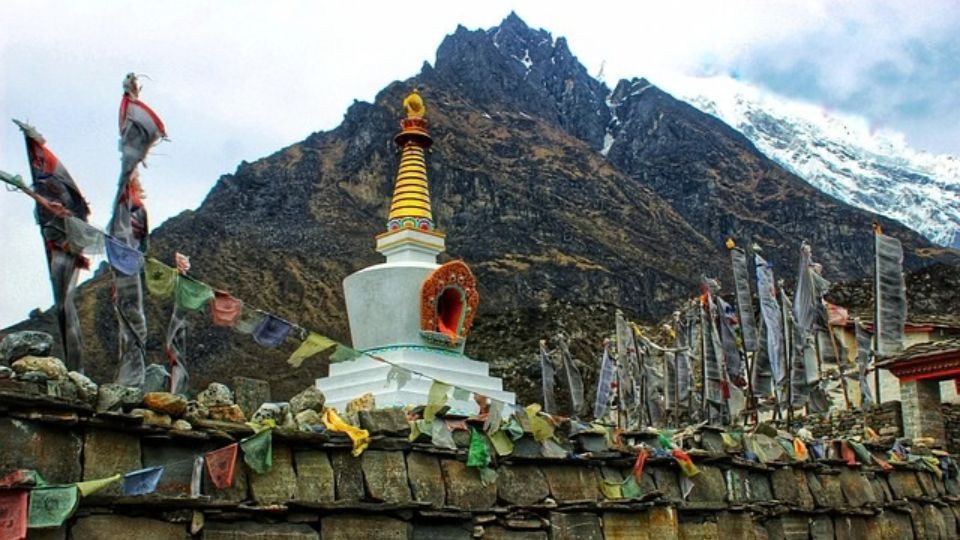
Tibetan Buddhism dictates the spiritual and architectural framework of the Langtang region. Monks and local practitioners construct thousands of religious monuments including stone mani walls inscribed with sacred mantras, vibrantly colored prayer flags, and dome-shaped chortens (stupas) along the primary trekking corridors. These physical structures function as continuous spiritual anchors for the communities. Village shamans, known locally as lamas or jhankris, conduct healing rituals and guide spiritual ceremonies to maintain harmony between the local inhabitants and the harsh mountain environment.
Kyanjin Gompa: The Spiritual Heart of the Valley
Kyanjin Gompa functions as the final village in Langtang Valley and as a central monastic institution for the upper Langtang Valley. This ancient Buddhist monastery provides a dedicated space for meditation, daily prayer rituals (pujas), and regional religious instruction. Monks established Kyanjin Gompa centuries ago to anchor Tibetan Buddhist teachings directly beneath the Langtang Lirung peak. The structure features traditional Tibetan architecture, housing complex thangka paintings and sacred artifacts. In addition to its religious function, the Kyanjin Gompa settlement operates the region’s first commercial yak cheese factory. Established in 1955 with Swiss assistance, this facility provides a sustainable economic foundation for the surrounding Tamang communities.
Gosainkunda Lake: Tracing the Mythology of Lord Shiva
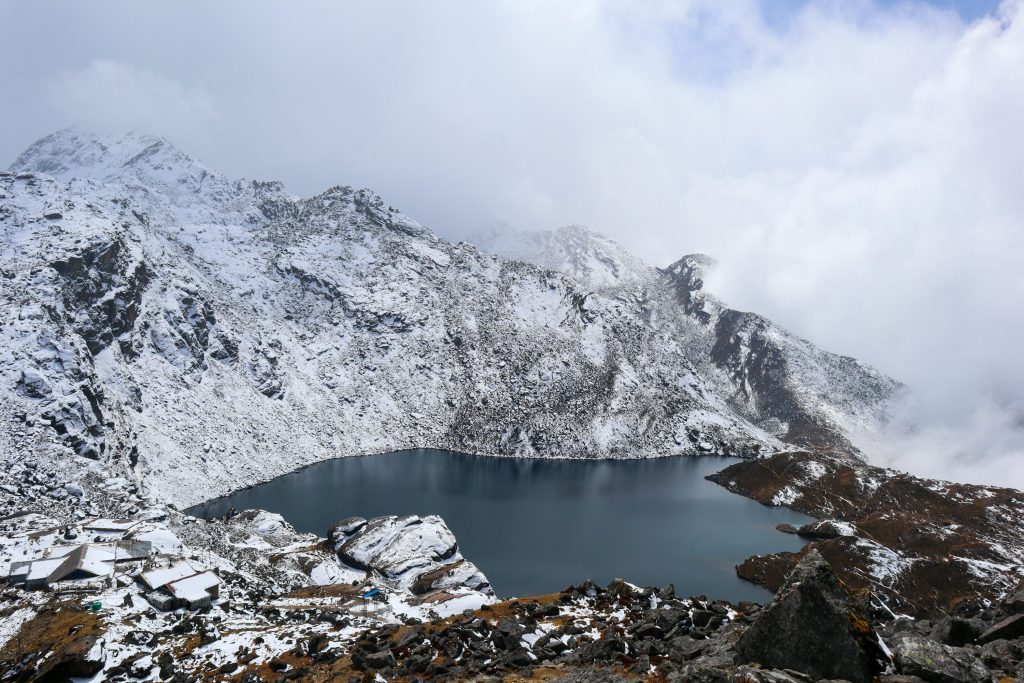
The alpine freshwater system of Gosainkunda Lake, located at 4,380 meters (14,370 feet), serves as a major pilgrimage destination for Hindu and Buddhist devotees. Hindu texts, specifically the Vishnu Purana and Bhagavata Purana, explicitly link the lake’s origin to the Samudra Manthan (churning of the cosmic ocean). According to Hindu mythology, Lord Shiva consumed a world-destroying poison called Halahala during this cosmic event. To cool his burning throat, Lord Shiva struck the Himalayan rock with his trident (Trishul), extracting the glacial water that formed Gosainkunda. Today, Hindu pilgrims believe that immersing themselves in these oligotrophic waters cleanses the body of spiritual sins and secures divine blessings.
Local Festivals in Langtang National Park
The communities within Langtang National Park observe specific high-altitude festivals that synchronize religious devotion with the seasonal Himalayan calendar.
- Janai Purnima (August): During the summer full moon, thousands of Hindu devotees and traditional shamans (Jhankris) ascend to Gosainkunda Lake. Hindu men bathe in the glacial waters to ritually renew their sacred cotton threads (Janai), actively fulfilling their religious vows while chanting Vedic mantras.
- Sonam Lhosar (January/February): Tamang communities celebrate Sonam Lhosar to mark the Tibetan New Year. Villagers perform traditional Syabru dances, share ceremonial feasts, and replace weathered prayer flags to invite prosperity for the upcoming agricultural cycle.
- Buddha Jayanti (April/May): Buddhist practitioners commemorate the birth, enlightenment, and passing of Lord Buddha during the spring full moon. Monasteries across the Langtang Valley, including Kyanjin Gompa, host extended prayer sessions and community chanting to reinforce their spiritual heritage.